Sieniawka, Zgorzelec County
| Sieniawka | |
|---|---|
| Village | |
 | |
 Sieniawka  Sieniawka | |
| Coordinates: 50°53′45″N 14°50′35″E / 50.89583°N 14.84306°ECoordinates: 50°53′45″N 14°50′35″E / 50.89583°N 14.84306°E | |
| Country |
|
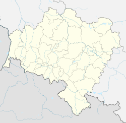
| Voivodeship | Lower Silesian |
| County | Zgorzelec |
| Gmina | Bogatynia |
| Population | 678 |
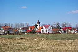
Sieniawka [ɕeˈɲafka] (German: Kleinschönau) is a village in the administrative district of Gmina Bogatynia, within Zgorzelec County, Lower Silesian Voivodeship, in south-western Poland, close to the Czech and German borders.[1] Prior to 1945 it was part of the German state of Saxony, from which it has been cut off by the Oder Neisse line.
It lies approximately 10 kilometres (6 mi) west of Bogatynia, 31 kilometres (19 mi) south of Zgorzelec, and 156 kilometres (97 mi) west of the regional capital Wrocław.
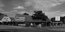
Market in Sieniawka
References
| Town and seat |  | |
|---|---|---|
| Villages | ||
This article is issued from
Wikipedia.
The text is licensed under Creative Commons - Attribution - Sharealike.
Additional terms may apply for the media files.