Siede
| Siede | |
|---|---|
 | |
| State | Lower Saxony, Germany |
| Physical characteristics | |
| Main source | Reihausen near Engeln |
| River mouth |
into the Große Aue about 31 m above sea level (NN) 52°35′51″N 8°56′26″E / 52.59750°N 8.94056°ECoordinates: 52°35′51″N 8°56′26″E / 52.59750°N 8.94056°E |
| Length | 24.6 km (15.3 mi) [1] |
| Basin features | |
| Progression | Große Aue→ Weser→ North Sea |
| Landmarks | Villages: Siedenburg |
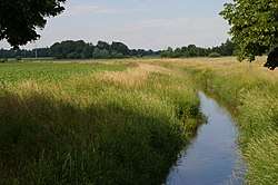
The Siede is a left-hand (northern) tributary of the Große Aue, about 25 kilometres (16 mi) long in north Germany. It runs mainly through the southern part of the district of Diepholz and belongs to the Weser river system.
Course
The Siede emerges near Reihausen in the village of Engeln in the parish of Bruchhausen-Vilsen, flows in a southerly direction through Siedenburg to which has given its name. It then leaves Diepholz district and discharges into the Große Aue in the district of Nienburg.
The tributaries of the Siede are the Kuhlenkamper Beeke (= upper and middle reaches of the Päpser Bach), the Speckenbach and the Eschbach.
References
External links
- "Überschwemmungsgebiet für Siede und Speckenbach verkleinert" (Presseinformation des NLWKN vom 5. Juli 2006) (PDF file; 22 kB)
This article is issued from
Wikipedia.
The text is licensed under Creative Commons - Attribution - Sharealike.
Additional terms may apply for the media files.