Shoal Creek (Spring River tributary)
| Shoal Creek | |
| Creek | |
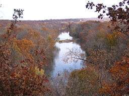 Shoal Creek from Inspiration Point, near Joplin, Missouri | |
| Country | United States |
|---|---|
| State | Missouri |
| Region | Southwest Missouri - Southeast Kansas |
| Source | |
| - location | Barry County, Missouri |
| - coordinates | 36°38′51″N 93°57′45″W / 36.64750°N 93.96250°W} |
| Mouth | Spring River |
| - location | Cherokee County, Kansas |
| - elevation | 246 m (807 ft) |
| - coordinates | 37°03′17″N 94°42′03″W / 37.05472°N 94.70083°WCoordinates: 37°03′17″N 94°42′03″W / 37.05472°N 94.70083°W |
| [1] | |
Shoal Creek is an 81.5-mile-long (131.2 km)[2] stream tributary of the Spring River in southwest Missouri and southeast Kansas. It begins in Barry County, Missouri southwest of Exeter and flows west through Newton county in Missouri before emptying into the Spring River near Riverton in Cherokee County, Kansas.
Grand Falls
South of Joplin the stream flows over Grand Falls, a large waterfall that spans the entire creek from bank to bank. In the 1890s a hydroelectric plant was built at the site but has since been abandoned. A theatre, boat houses, a German Village and a dance pavilion were built by the falls in the early 20th century and the Missouri Pacific Railroad shuttled visitors to the site.[3]
See also
References
- ↑ GNIS for Shoal Creek
- ↑ U.S. Geological Survey. National Hydrography Dataset high-resolution flowline data. The National Map, accessed May 31, 2011
- ↑ History of Great Falls
This article is issued from
Wikipedia.
The text is licensed under Creative Commons - Attribution - Sharealike.
Additional terms may apply for the media files.