Shining Sea Bikeway
| Shining Sea Bikeway | |
|---|---|
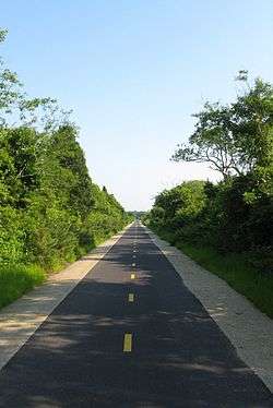 The trail in West Falmouth | |
| Length | 10.7 mi (17.2 km) |
| Location | Barnstable County |
| Trailheads |
1 Cowdry Road, Woods Hole County Road, North Falmouth |
| Use | Hiking, bicycling, horseback riding, roller blading, and cross country skiing |
| Hiking details | |
| Season | year-round |
| Hazards |
deer ticks poison ivy road crossings |
| Surface | Paved surface |
| Right of way | former railroad line |
The Shining Sea Bikeway is a rail trail on Cape Cod in Falmouth, Massachusetts, United States. The path runs for 10.7 miles (17.2 km)[1] from the Steamship Authority ferry terminal in Woods Hole to North Falmouth.
History
The trail was built on the right-of-way of the Old Colony Railroad's Woods Hole branch line, which was built in 1872. In 1893, the New York, New Haven and Hartford Railroad (NH) leased the Old Colony and took over service on the line. Passenger service was discontinued in 1964, the NH merged with the Penn Central system in 1969, and Penn Central went bankrupt in 1970.
The creation of the trail began in 1977, when the Town of Falmouth purchased the section of the bankrupt line running from downtown Falmouth to Woods Hole for $329,000.[2] In 2009, the trail was extended an additional 8 miles (13 km) from downtown Falmouth to North Falmouth.[1] Freight service on this section ceased in 1989.
While the Woods Hole-Falmouth section of former railroad is owned by the Town of Falmouth, the Falmouth-North Falmouth section is owned by the Massachusetts Department of Transportation and is not officially abandoned.
The name of the trail is a reference to the patriotic song "America the Beautiful". The author of the song's lyrics, Katherine Lee Bates, was born in Falmouth, and there is a plaque commemorating her poem near mile marker 2.[3]
Route description
The Shining Sea Bikeway's northern trailhead is at the former site of the North Falmouth Railroad Station on County Road in North Falmouth. For the first 1,000 feet (300 m), the path runs adjacent to active track used to haul trash off-Cape from the Upper Cape Regional Transfer Station on Joint Base Cape Cod. The path runs south roughly parallel to Route 28A through the villages of North Falmouth and West Falmouth. Between North and West Falmouth, it passes through a cranberry bog and crosses the horse trails at Bourne Farm. In West Falmouth, it passes near Chapoquoit Beach and then runs through the Sippewissett Salt Marsh.
After the salt marsh, the path turns southeast and climbs slightly into the village of Sippewissett and then turns southwest and enters downtown Falmouth. In Falmouth, the path runs through a Steamship Authority parking lot and passes the former Falmouth Railroad Station, which is used as a bus station.
At Woods Hole Road, the path reaches its downtown parking lot, which was its northernmost trailhead until the 2009 extension. It then crosses Woods Hole Road and continues southwest past Salt Pond to Surf Drive Beach. At Surf Drive, the path follows the beach for 0.5 miles (800 m) and then heads inland. Turning east, it passes through another Steamship Authority parking lot and ends at the Steamship Authority ferry terminal and the former site of the Woods Hole Railroad Station in the village of Woods Hole.
See also
References
- 1 2 "Bikeways Committee". Town of Falmouth. Retrieved March 19, 2017.
- ↑ "Town of Falmouth - History of the Shining Sea Bikeway". Falmouthmass.us. 2009-07-29. Retrieved 2016-03-14.
- ↑ "Shining Sea Bikeway" (PDF). Friendsoffalmouthbikeways.com. Retrieved 2016-03-14.
Further reading
- Frisbee, Kathy Sharp (2009). "The Shining Sea Bikeway: A path through the natural history and cultural heritage of Falmouth on Cape Cod" (PDF). Town of Falmouth.
External links
| Wikimedia Commons has media related to Shining Sea Bikeway. |
Route map: