Shawnee, Wyoming
| Shawnee, Wyoming | |
|---|---|
| Unincorporated community | |
 Shawnee, Wyoming Location within the state of Wyoming | |
| Coordinates: 42°44′52″N 105°0′35″W / 42.74778°N 105.00972°WCoordinates: 42°44′52″N 105°0′35″W / 42.74778°N 105.00972°W | |
| Country | United States |
| State | Wyoming |
| County | Converse |
| Elevation | 5,059 ft (1,542 m) |
| Time zone | UTC-7 (Mountain (MST)) |
| • Summer (DST) | UTC-6 (MDT) |
| ZIP codes | 82229 |
| GNIS feature ID | 1594167[1] |
Shawnee is an unincorporated community in southeastern Converse County, Wyoming, United States. It lies along the concurrent U.S. Routes 18 and 20 east of the city of Douglas, the county seat of Converse County.[2] Its elevation is 5,059 feet (1,542 m).[1]
History
A post office called Shawnee was established in 1887,[3] and remained in operation until it closed in 2007.[4] The community took its name from nearby Shawnee Creek.[5]
Education
Public education in the community of Shawnee is provided by Converse County School District #1. Zoned campuses include Shawnee School (grades K-8) and Douglas High School (grades 9-12).
References
- 1 2 "Shawnee, Wyoming". Geographic Names Information System. United States Geological Survey.
- ↑ Rand McNally. The Road Atlas '08. Chicago: Rand McNally, 2008, p. 116.
- ↑ "Converse County". Jim Forte Postal History. Retrieved 28 March 2015.
- ↑ http://about.usps.com/who-we-are/postmasterfinder/welcome.htm
- ↑ Chicago and North Western Railway Company (1908). A History of the Origin of the Place Names Connected with the Chicago & North Western and Chicago, St. Paul, Minneapolis & Omaha Railways. p. 124.
Municipalities and communities of Converse County, Wyoming, United States | ||
|---|---|---|
| City | 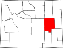 | |
| Towns | ||
| CDPs | ||
| Unincorporated communities | ||
This article is issued from
Wikipedia.
The text is licensed under Creative Commons - Attribution - Sharealike.
Additional terms may apply for the media files.