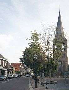
Sevenum
| Sevenum Zaerum | |||
|---|---|---|---|
| City and former municipality | |||
| |||
| Coordinates: 51°25′N 6°02′E / 51.417°N 6.033°E | |||
| Country | Netherlands | ||
| Province | Limburg | ||
| Municipality | Horst aan de Maas | ||
| Time zone | UTC+1 (CET) | ||
| • Summer (DST) | UTC+2 (CEST) | ||


Sevenum (![]()
Location
Sevenum's neighbour towns are (clockwise, starting from East): Blerick, Venlo, Maasbree, Kronenberg, Grubbenvorst, Hegelsom, Horst, Grubbenvorst.
Sevenum-town and Kronenberg are tangented by highway E34, provincial road N277 (Middenpeelweg), and the railroad track Eindhoven-Venlo; Evertsoord lies on the edge of the Peel, a former peatland.
Dialect

Sevenum's dialect, "Zaerums", is transitional between Limburgish, North-Limburgish (see Low Rhenish), and Brabantian. Different groupings of dialects exist; in the diagram "Kleverlandish" on this page, Sevenum is situated near the bottom-left corner of the blue area, which is the intersection of the horizontal "ich/ik" isogloss (the Uerdingen line) with the vertical "kalt/koud" isogloss.
The overview of town names in Limburgish at Streektaal.net [1] lists "Zaerum" (Sevenum) and "De Kroeënenberg" (Kronenberg), but it doesn't include "De Pieël" (Evertsoord), considering it to be in the North-Limburgish area.
References
External links
- Tourist information for Northern Limburg
- Tourist information (in Dutch) on the website of the municipality Horst aan de Maas
| Wikimedia Commons has media related to Sevenum. |
Coordinates: 51°25′N 6°02′E / 51.417°N 6.033°E
| Authority control |
|---|