Serra de Paüls
| Serra de Paüls | |
|---|---|
 Montsagre de Paüls | |
| Highest point | |
| Peak | Punta de l'Aigua |
| Elevation | 1,091.6 m (3,581 ft) |
| Coordinates | 40°56′52.8″N 0°23′15.5″E / 40.948000°N 0.387639°ECoordinates: 40°56′52.8″N 0°23′15.5″E / 40.948000°N 0.387639°E |
| Geography | |
 Serra de Paüls Location in Catalonia | |
| Location | Terra Alta and Baix Ebre |
| Parent range | Ports de Tortosa-Beseit |
| Geology | |
| Orogeny | Alpine orogeny |
| Type of rock | Limestone |
| Climbing | |
| Easiest route | Drive from Paüls or Prat de Comte |
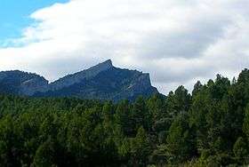
Serra de Paüls is a mountain range in the northern side of the Ports de Tortosa-Beseit, Catalonia, Spain. The highest summit, Punta de l'Aigua has an elevation of 1,091.6 metres above sea level.[1]
Geography
The central part of the range is known as Montsagre de Paüls.
This range is named after the town of Paüls, located on its SE side. Together with neighboring and parallel Serra de l'Espina the Serra de Paüls is within the geological area that connects the Ports de Tortosa-Beseit mountain massif with the Catalan Pre-Coastal Range.[2]
See also
References
- ↑ "Mapa Topogràfic de Catalunya". Institut Cartogràfic de Catalunya. Retrieved 9 September 2010. .
- ↑ Ports de Beseit
External links

- Excursió al Montsagre de Paüls
- Dadescat
- Bolós i Vigo - Alyssum montanum
This article is issued from
Wikipedia.
The text is licensed under Creative Commons - Attribution - Sharealike.
Additional terms may apply for the media files.