Serhetabat
| Serhetabat | |
|---|---|
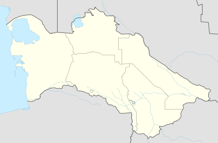 Serhetabat Location in Turkmenistan | |
| Coordinates: 35°17′N 62°21′E / 35.283°N 62.350°E | |
| Country |
|
| Province | Mary Province |
| Elevation[1] | 747 m (2,454 ft) |
| Population (1991) | |
| • Total | 5,200 (approximate) |
| Time zone | UTC+5 (TMT) |
Serhetabat (formerly Guşgy in Turkmen, Kushka or Kuschka in Russian) is a small town in the Mary Province in Turkmenistan, located in the valley of the Kushka River. The population is 5,200 (1991). It is immediately opposite to Torghundi in Afghanistan, with which it is connected by a road and a 1,520 mm (4 ft 11 27⁄32 in) gauge railway.
Overview
In 1885, Serhetabat and the surrounding region was seized from Afghanistan by the Russian forces as a result of the Panjdeh Incident (also referred to as the Battle of Kushka), in which about 600 Afghan soldiers were overwhelmed by over 2500 Russian forces.[2]
The settlement was founded in 1890 as a Russian military outpost. A local rail line branching from Merv on the Central Asian Railway was inaugurated on 1 March 1901, causing some degree of international excitement.[3]
The town of Kushka used to be the southernmost point of the Russian Empire and Soviet Union. A 10-metre stone cross, installed to commemorate the tercentenary of the Romanov Dynasty in 1913, is a memorial to this fact.
Transport
The broad gauge former Soviet Railway crosses into Afghanistan at the station, Torghundi being the railhead station on the other side. It was built in 1960.[4] In 2007, this line was restored to use.[5]
Climate
Serhetabat has a semi-arid climate (Köppen climate classification BSh), with cool winters and very hot summers. Rainfall is moderate in winter and spring, but summer is extremely dry.
| Climate data for Serhetabat | |||||||||||||
|---|---|---|---|---|---|---|---|---|---|---|---|---|---|
| Month | Jan | Feb | Mar | Apr | May | Jun | Jul | Aug | Sep | Oct | Nov | Dec | Year |
| Record high °C (°F) | 27.1 (80.8) |
31.0 (87.8) |
34.5 (94.1) |
37.8 (100) |
42.3 (108.1) |
47.6 (117.7) |
45.3 (113.5) |
43.5 (110.3) |
43.4 (110.1) |
38.6 (101.5) |
33.2 (91.8) |
31.5 (88.7) |
47.6 (117.7) |
| Average high °C (°F) | 9.5 (49.1) |
11.6 (52.9) |
17.0 (62.6) |
23.6 (74.5) |
30.0 (86) |
35.1 (95.2) |
37.0 (98.6) |
35.5 (95.9) |
30.3 (86.5) |
24.2 (75.6) |
18.3 (64.9) |
12.0 (53.6) |
23.7 (74.7) |
| Daily mean °C (°F) | 3.6 (38.5) |
5.4 (41.7) |
10.4 (50.7) |
16.3 (61.3) |
21.9 (71.4) |
27.1 (80.8) |
29.3 (84.7) |
27.4 (81.3) |
21.2 (70.2) |
14.9 (58.8) |
9.9 (49.8) |
5.5 (41.9) |
16.1 (61) |
| Average low °C (°F) | −0.8 (30.6) |
0.6 (33.1) |
5.1 (41.2) |
9.7 (49.5) |
13.8 (56.8) |
17.8 (64) |
19.8 (67.6) |
17.7 (63.9) |
12.0 (53.6) |
6.7 (44.1) |
3.6 (38.5) |
0.8 (33.4) |
8.9 (48) |
| Record low °C (°F) | −33.8 (−28.8) |
−27.7 (−17.9) |
−19.6 (−3.3) |
−5.5 (22.1) |
−0.8 (30.6) |
4.1 (39.4) |
9.7 (49.5) |
5.5 (41.9) |
−3.7 (25.3) |
−10.5 (13.1) |
−19.3 (−2.7) |
−24.5 (−12.1) |
−33.8 (−28.8) |
| Average precipitation mm (inches) | 52 (2.05) |
50 (1.97) |
78 (3.07) |
38 (1.5) |
13 (0.51) |
0.5 (0.02) |
0 (0) |
0 (0) |
0.5 (0.02) |
4 (0.16) |
17 (0.67) |
42 (1.65) |
295 (11.61) |
| Average rainy days | 7 | 9 | 11 | 7 | 3 | 0.3 | 0.1 | 0.1 | 0.3 | 2 | 5 | 7 | 52 |
| Average snowy days | 5 | 6 | 2 | 0.3 | 0 | 0 | 0 | 0 | 0 | 0.1 | 1 | 3 | 17 |
| Average relative humidity (%) | 74 | 73 | 71 | 62 | 43 | 28 | 25 | 25 | 30 | 43 | 58 | 71 | 50 |
| Mean monthly sunshine hours | 135 | 132 | 156 | 210 | 323 | 371 | 384 | 365 | 314 | 265 | 186 | 136 | 2,977 |
| Source #1: Pogoda.ru.net[6] | |||||||||||||
| Source #2: NOAA (sun only, 1961–1990)[7] | |||||||||||||
References
- ↑ "Kushka, Turkmenistan". Falling Rain Global Gazetteer. Retrieved 1 February 2013.
- ↑ Clements, Frank. Conflict in Afghanistan: A Historical Encyclopedia. pp 198. Retrieved 2012-09-03.
- ↑ "Russia's secret railroad: Unknown to the world, 220 miles of rails have been laid". The Deseret News. 1899-04-08.
- ↑ Hamid Wahed Alikuzai A Concise History of Afghanistan in 25 Volumes, Volume 1 at Google Books
- ↑ "Afghan rebuild underway". Railway Gazette International. 12 July 2007.
- ↑ "Weather and Climate-The Climate of Serhetabat" (in Russian). Weather and Climate (Погода и климат). Retrieved 18 March 2016.
- ↑ "Climate Normals for Kuska". National Oceanic and Atmospheric Administration. Retrieved 1 February 2013.