Seneca, New Mexico
| Seneca, New Mexico | |
|---|---|
| Unincorporated community | |
 Seneca, New Mexico | |
| Coordinates: 36°37′42″N 103°07′36″W / 36.62833°N 103.12667°WCoordinates: 36°37′42″N 103°07′36″W / 36.62833°N 103.12667°W | |
| Country | United States |
| State | New Mexico |
| County | Union |
| Elevation | 4,990 ft (1,520 m) |
| Time zone | UTC-7 (Mountain (MST)) |
| • Summer (DST) | UTC-6 (MDT) |
| Area code(s) | 575 |
| GNIS feature ID | 910940[1] |
Seneca is an unincorporated community in Union County, New Mexico, United States.[1] Seneca is located on New Mexico State Road 406 12.6 miles (20.3 km) north-northeast of Clayton.
References
Municipalities and communities of Union County, New Mexico, United States | ||
|---|---|---|
| Town | 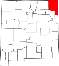 | |
| Villages | ||
| CDP | ||
| Other unincorporated communities | ||
This article is issued from
Wikipedia.
The text is licensed under Creative Commons - Attribution - Sharealike.
Additional terms may apply for the media files.