Senador Vasconcelos
| Senador Vasconcelos | |
|---|---|
| Neighborhood | |
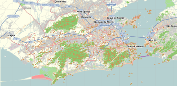 Senador Vasconcelos Location in Rio de Janeiro  Senador Vasconcelos Senador Vasconcelos (Brazil) | |
| Coordinates: 22°53′44″S 43°31′39″W / 22.89556°S 43.52750°WCoordinates: 22°53′44″S 43°31′39″W / 22.89556°S 43.52750°W | |
| Country |
|
| State | Rio de Janeiro (RJ) |
| Municipality/City | Rio de Janeiro |
| Zone | West Zone |
Senador Vasconcelos is a neighborhood of lower class in the West Zone of Rio de Janeiro, Brazil.
Neighborhood statistics
- Total area (2003): 644.18 hectares.
- Total population (2000): 27,285.
- Total of domiciles (2000): 7,829.
- Administrative region: XVIII - Campo Grande.
References
This article is issued from
Wikipedia.
The text is licensed under Creative Commons - Attribution - Sharealike.
Additional terms may apply for the media files.