Washington State Route 141
| ||||
|---|---|---|---|---|
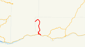 SR 141 highlighted in red. | ||||
| Route information | ||||
| Auxiliary route of SR 14 | ||||
| Defined by RCW 47.17.275 | ||||
| Maintained by WSDOT | ||||
| Length | 29.30 mi[1] (47.15 km) | |||
| Existed | 1964[2]–present | |||
| Major junctions | ||||
| South end |
| |||
| North end | Gifford Pinchot National Forest boundary at the Klickitat / Skamania county line | |||
| Highway system | ||||
| ||||

State Route 141 is a state highway in the U.S. state of Washington, running from SR 14 in Bingen to the Skamania County line west of Trout Lake, travelling along the Wild and Scenic White Salmon River to the base of Mount Adams. At the Gifford Pinchot National Forest border, it becomes Forest Road 24, also known as the Carson-Guler Road. It is a major access to recreation areas on the south side of Mount Adams, including the Mount Adams Wilderness and the Mount Adams Recreation Area.
Route description

Beginning in downtown Bingen at SR 14, SR 141 travels up a long grade to White Salmon. After passing through the downtown, SR 141 travels through rural White Salmon, intersecting with SR 141 Alternate and continues northward along the Wild and Scenic White Salmon River to BZ Corner, and ends at rural Trout Lake at the southern base of Mount Adams, towering at 12,276 ft. The road travels through vegetation showing the convergence of the moist west side and drier east side of the Cascades, as seen by the Ponderosa Pine-dominated sunny forests.
A 2.16-mile (3.48 km) alternate route connects SR 141 to SR 14 in Underwood.
History
Between 1964 and 1967, SR 121 ran throughout the route that SR 141 travels today. In 1967, what had been SR 12 was renumbered SR 14, and SR 121 was renumbered to reflect that. During that time, SR 141 ran from Riffe (near Morton) to SR 7 in Morton. It became part of a realigned U.S. Route 12 in 1967.
Prior to the 1964 renumbering, current State Route 141 was designated Secondary State Highway 8-D. It was added to the state highway system in 1937. SR 141 Alternate was added to the state highway system in 1951, also as part as SSH 8-D.
Major intersections
The entire highway is in Klickitat County.
| Location | mi[1] | km | Destinations | Notes | |
|---|---|---|---|---|---|
| Bingen | |||||
| White Salmon | 1.08 | 1.74 | Sixth Avenue | ||
| | 4.69 | 7.55 | North end of SR 141 Alternate | ||
| BZ Corner | 12.55 | 20.20 | BZ-Glenwood Highway | ||
| | 29.30 | 47.15 | Carson Guler Road west | Continuation into Skamania County | |
| 1.000 mi = 1.609 km; 1.000 km = 0.621 mi | |||||
References
Route map:
- 1 2 Washington State Department of Transportation (2006). "State Highway Log: Planning Report, SR 2 to SR 971" (PDF). Retrieved July 12, 2009.
- ↑ Washington State Legislature (1970). "RCW 47.17.275: State route No. 141". Retrieved July 12, 2009.