Washington State Route 172
| ||||
|---|---|---|---|---|
 SR 172 is highlighted in red. | ||||
| Route information | ||||
| Auxiliary route of SR 17 | ||||
| Defined by RCW 47.17.355 | ||||
| Maintained by WSDOT | ||||
| Length | 35.01 mi[1] (56.34 km) | |||
| Existed | 1964[2]–present | |||
| Major junctions | ||||
| West end |
| |||
| East end |
| |||
| Location | ||||
| Counties | Douglas | |||
| Highway system | ||||
| ||||

State Route 172 (SR 172) is a 35.01-mile (56.34 km) long state highway serving rural Douglas County in the U.S. state of Washington. The highway travels north from U.S. Route 2 (US 2) at Farmer through Withrow and east through Mansfield before ending at SR 17 at Sims Corner. The highway follows the route of a county road built in the 1930s and signed as Secondary State Highway 10B (SSH 10B) in 1955. SSH 10B became SR 172 during the 1964 highway renumbering and served a daily average of less than 700 vehicles in 2011.
Route description
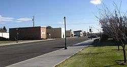
SR 172 begins as Road C NW at an intersection with US 2 at the unincorporated community of Farmer, between Waterville and Coulee City.[3] The highway travels north through farmland and serves Withrow before climbing Lone Butte and turning east into 14th Road NW.[1][4][5] SR 172 continues east into Mansfield,[6] where it becomes Main Street and turns southeast into Downtown at Mansfield High School.[7] The roadway turns northeast onto Railroad Avenue, serving the Mansfield Airport.[8] SR 172 leaves Mansfield and continues east as 14th Road NE until it ends at SR 17 at Sims Corner, north of Coulee City.[9][10][11]
Every year the Washington State Department of Transportation (WSDOT) conducts a series of surveys on its highways in the state to measure traffic volume. This is expressed in terms of average annual daily traffic (AADT), which is a measure of traffic volume for any average day of the year. In 2011, WSDOT calculated that between 200 and 690 vehicles per day used the highway, mostly in Mansfield.[12]
History
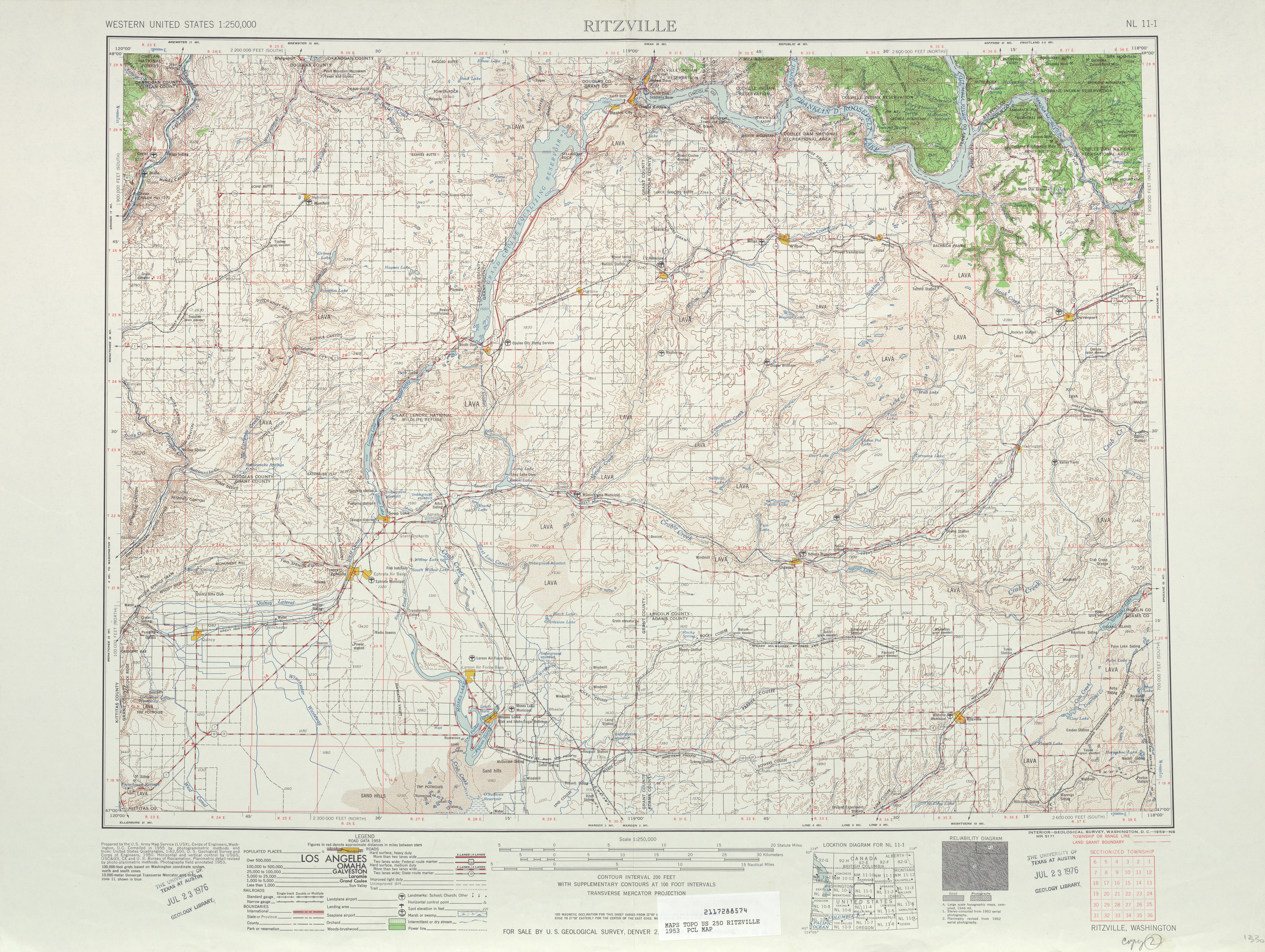
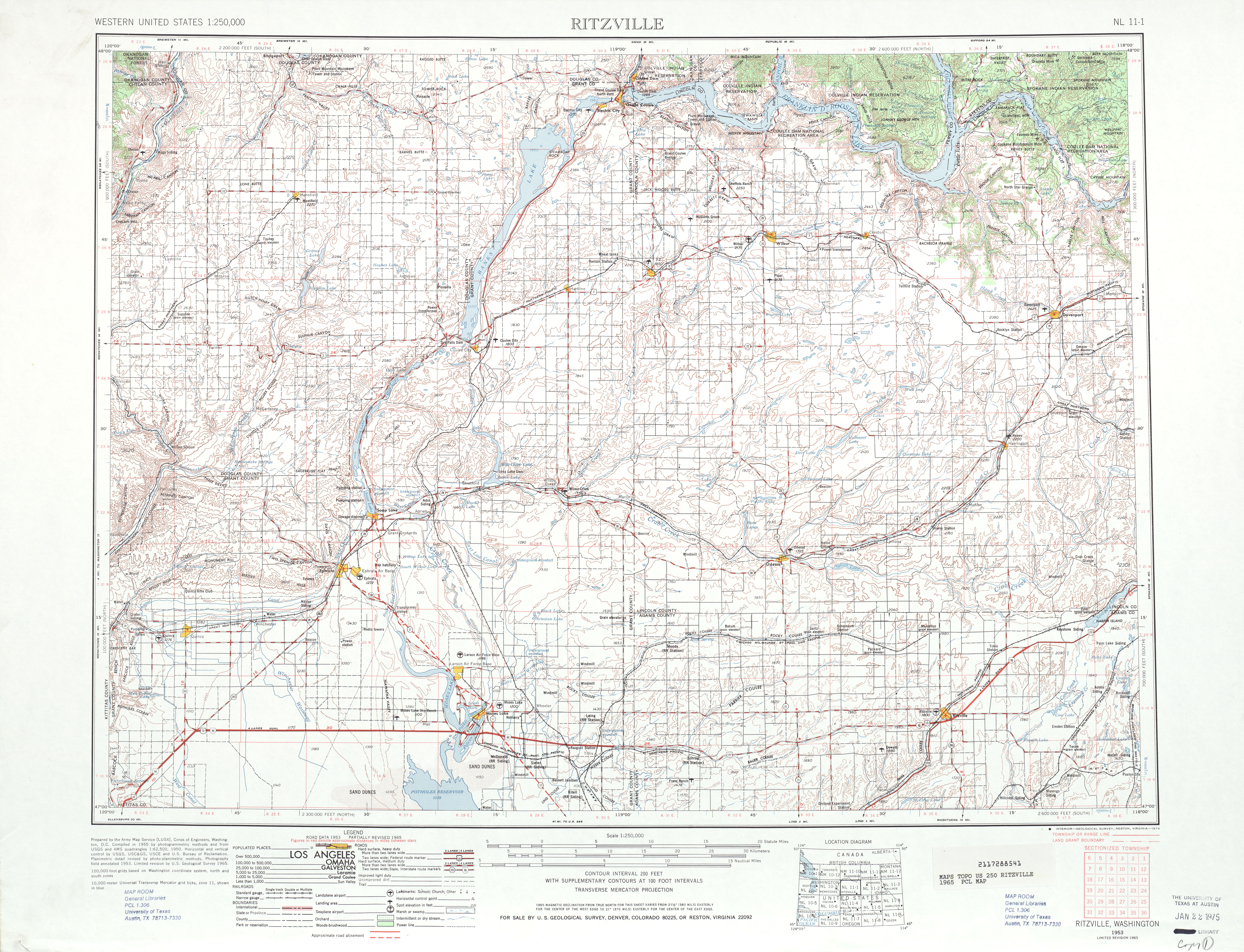
A gravel county road extending from Lone Butte through Mansfield to Sims Corner first appeared in a 1933 Department of Highways map of Washington.[13] The road was paved and used temporarily by Primary State Highway 10 (PSH 10) until a Bridgeport–Leahy road was built to the northeast in the 1950s.[14][15] A paved road from Mansfield to Withrow and Farmer was built by 1950 and was signed as an extension of Secondary State Highway 10B (SSH 10B) in 1955.[16][17] SSH 11B was split into SR 172 and SR 174 in the 1964 highway renumbering,[2][18][19] and no major revisions to the highway has occurred since.[20]
Major intersections
The entire highway is in Douglas County.
| Location | mi[1] | km | Destinations | Notes | |
|---|---|---|---|---|---|
| Farmer | 0.00 | 0.00 | Western terminus | ||
| | 35.01 | 56.34 | Eastern terminus | ||
| 1.000 mi = 1.609 km; 1.000 km = 0.621 mi | |||||
References
- 1 2 3 Staff (2012), State Highway Log: Planning Report 2011, SR 2 to SR 971 (PDF), Washington State Department of Transportation, pp. 1164&ndash, 1167, retrieved January 15, 2013
- 1 2 "47.17.355: State route No. 172", Revised Code of Washington, Washington State Legislature, 1970, retrieved January 15, 2013
- ↑ "Feature Detail Report for: Farmer", Geographic Names Information System, United States Geological Survey, September 10, 1979, retrieved January 15, 2013
- ↑ "Feature Detail Report for: Withrow", Geographic Names Information System, United States Geological Survey, September 10, 1979, retrieved January 15, 2013
- ↑ "Feature Detail Report for: Lone Butte", Geographic Names Information System, United States Geological Survey, September 10, 1979, retrieved January 15, 2013
- ↑ "Feature Detail Report for: Mansfield", Geographic Names Information System, United States Geological Survey, September 10, 1979, retrieved January 15, 2013
- ↑ "Feature Detail Report for: Mansfield High School", Geographic Names Information System, United States Geological Survey, March 1, 1993, retrieved January 15, 2013
- ↑ "Feature Detail Report for: Mansfield Airport", Geographic Names Information System, United States Geological Survey, March 1, 1990, retrieved January 15, 2013
- ↑ "Feature Detail Report for: Sims Corner", Geographic Names Information System, United States Geological Survey, September 10, 1979, retrieved January 15, 2013
- ↑ Google (January 15, 2013). "State Route 172" (Map). Google Maps. Google. Retrieved January 15, 2013.
- ↑ Douglas County 2010 Road Atlas (PDF) (Map) (2010 ed.). 1:16,000. East Wenatchee, Washington: Douglas County Transportation & Land Services. April 2010. pp. 111, 119. Retrieved January 15, 2013.
- ↑ Staff (2011), 2011 Annual Traffic Report (PDF), Washington State Department of Transportation, p. 152, retrieved January 15, 2013
- ↑ Highway Map of the State of Washington (DJVU) (Map). Department of Highways. April 1, 1933. Retrieved January 15, 2013.
- ↑ Highways of the State of Washington (DJVU) (Map). Department of Highways. 1939. Retrieved January 15, 2013.
- ↑ "Chamber Session Broad in Scope", Spokane Daily Chronicle, Spokane, Washington, April 2, 1949, retrieved January 15, 2013
- ↑ Washington State Legislature (1955), Session Laws of the State of Washington, Session Laws of the State of Washington (1955 ed.), Olympia, Washington: Washington State Legislature
- ↑ Ritzville, 1953 (JPG) (Map). 1:250,000. United States Geological Survey. 1953. Retrieved January 15, 2013.
- ↑ Prahl, C. G. (December 1, 1965), Identification of State Highways (PDF), Washington State Highway Commission, Department of Highways, retrieved January 15, 2013
- ↑ Ritzville, 1965 (JPG) (Map). 1:250,000. United States Geological Survey. 1965. Retrieved January 14, 2013.
- ↑ Washington State Highways, 2011–2012 (PDF) (Map). 1:842,000. Washington State Department of Transportation. 2011. Retrieved January 15, 2013.
External links
Route map:
| Wikimedia Commons has media related to Washington State Route 172. |