Sebhel
| Sebeel سبعل | |
|---|---|
| City | |
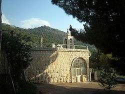 Church in Sebhel | |
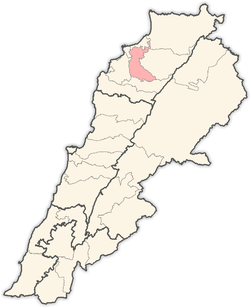
 Sebeel Location within Lebanon | |
| Coordinates: 34°18′53″N 35°54′31″E / 34.31472°N 35.90861°ECoordinates: 34°18′53″N 35°54′31″E / 34.31472°N 35.90861°E | |
| Country |
|
| Governorate | North Governorate |
| District | Zgharta District |
| Elevation | 637 m (2,090 ft) |
| Time zone | UTC+2 (EET) |
| • Summer (DST) | UTC+3 (EEST) |
| Dialing code | +961 |
Sebhel (also Sib'il, Sebaail, Sebeel, Arabic: سبعل) is a village located in the Zgharta District in the North Governorate of Lebanon.[1] Its population is Maronite Catholic.[2]
References
- ↑ Sebaal, Localiban
- ↑ "Municipal and ikhtiyariah elections in Northern Lebanon" (PDF). The Monthly. March 2010. p. 23. Archived from the original (PDF) on 3 June 2016. Retrieved 28 October 2016.
Capital: Zgharta | ||
| Towns and villages |
|  |
| Notable landmarks | ||
| History | ||
| Notable people |
| |
| Society |
| |
This article is issued from
Wikipedia.
The text is licensed under Creative Commons - Attribution - Sharealike.
Additional terms may apply for the media files.