Scorff
| Scorff | |
|---|---|
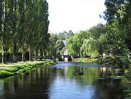 The Scorff in Pont-Scorff | |
| Country | France |
| Physical characteristics | |
| Main source | Brittany |
| River mouth |
Blavet 47°44′30″N 3°20′54″W / 47.74167°N 3.34833°WCoordinates: 47°44′30″N 3°20′54″W / 47.74167°N 3.34833°W |
| Length | 78.6 km (48.8 mi) |
| Discharge |
|
The Scorff River flows from central Brittany and enters the Atlantic Ocean on the south coast in Lorient.
The Scorff rises north of Langoëlan, in the Morbihan department, and flows through the towns of Guémené-sur-Scorff and Pont-Scorff. From there its bed enlarges to form a ria, submitted to the tides. It joins the Blavet in Lorient, where it enters the Ocean in the roadstead of Lorient.
It is 78.6 km (48.8 mi) long and its basin area is 483 km2 (186 sq mi).[1]
Tributaries
- The Scaff, in Pont-Scorff[1]
Fauna
The river is classified as "first category" (French: Cours d'eau de première catégorie);[2] it is home to Brown trout and Atlantic salmon.
References
- 1 2 Sandre. "Fiche cours d'eau - Scorff (J5--0220)".
- ↑ Morbihan angling association: Fédération départementale de pêche du Morbihan
This article is issued from
Wikipedia.
The text is licensed under Creative Commons - Attribution - Sharealike.
Additional terms may apply for the media files.