Schwandorf
| Schwandorf | ||
|---|---|---|
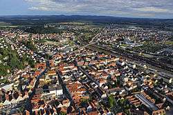 Aerial view | ||
| ||
 Schwandorf Location of Schwandorf within Schwandorf district 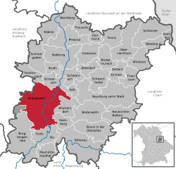 | ||
| Coordinates: 49°19′42″N 12°6′36″E / 49.32833°N 12.11000°ECoordinates: 49°19′42″N 12°6′36″E / 49.32833°N 12.11000°E | ||
| Country | Germany | |
| State | Bavaria | |
| Admin. region | Oberpfalz | |
| District | Schwandorf | |
| Government | ||
| • Lord Mayor | Andreas Feller (CSU) | |
| Area | ||
| • Total | 123.76 km2 (47.78 sq mi) | |
| Elevation | 366 m (1,201 ft) | |
| Population (2017-12-31)[1] | ||
| • Total | 28,730 | |
| • Density | 230/km2 (600/sq mi) | |
| Time zone | CET/CEST (UTC+1/+2) | |
| Postal codes | 92421 | |
| Dialling codes | 0 94 31 | |
| Vehicle registration | SAD | |
| Website | www.schwandorf.de | |

Schwandorf is a town on the river Naab in the Upper Palatinate, Bavaria, Germany, which is the seat of the Schwandorf district.
Sights
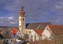
Catholic parish church of St. Jakob
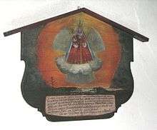
Anti nuclear reprocessing plant Wackersdorf ex-voto in Kreuzberg Church
- Catholic parish church of St. Jakob
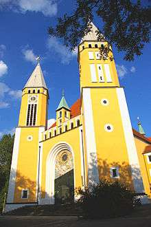
- Kreuzberg Church: Catholic parish, monastic and pilgrimage church of Mary Help of Christians on the Kreuzberg
Sports
The towns association football club, 1. FC Schwandorf, experienced its greatest success in the late 1950s and 1960 when it spent thirteen seasons in the third division Bayernliga.
International relations
Schwandorf is twinned with:
References
- ↑ "Fortschreibung des Bevölkerungsstandes". Bayerisches Landesamt für Statistik und Datenverarbeitung (in German). September 2018.
This article is issued from
Wikipedia.
The text is licensed under Creative Commons - Attribution - Sharealike.
Additional terms may apply for the media files.