Schwanberg, Styria
| Schwanberg | |
|---|---|
 Schwanberg Location within Austria | |
| Coordinates: 46°45′00″N 15°12′00″E / 46.75000°N 15.20000°ECoordinates: 46°45′00″N 15°12′00″E / 46.75000°N 15.20000°E | |
| Country | Austria |
| State | Styria |
| District | Deutschlandsberg |
| Government | |
| • Mayor | Mag. Karl-Heinz Schuster (ÖVP) |
| Area | |
| • Total | 12.04 km2 (4.65 sq mi) |
| Elevation | 427 m (1,401 ft) |
| Population (1 January 2016)[1] | |
| • Total | 4,553 |
| • Density | 380/km2 (980/sq mi) |
| Time zone | UTC+1 (CET) |
| • Summer (DST) | UTC+2 (CEST) |
| Postal code | 8541 |
| Area code | 03467 |
| Vehicle registration | DL |
| Website | www.schwanberg.gv.at |
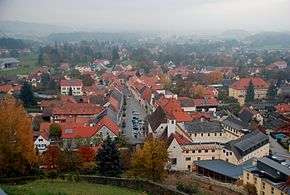
Schwanberg, from Josefkirche
Schwanberg is a market town, since 2015, in the Austrian state of Styria, in the district of Deutschlandsberg. It is situated on the eastern slopes of the Koralpe mountain range on the river Schwarze Sulm (Black Sulm), a major tributary of the river Sulm.
Schwanberg was expanded as part of the Styria municipal structural reform, at the end of 2014, by merging with the former municipalities Hollenegg, Gressenberg and Garanas, but continuing as the name "Schwanberg".
People from Schwanberg
- Wilhelm Gericke (1845-1925), conductor
Population
| Historical population | ||
|---|---|---|
| Year | Pop. | ±% |
| 1869 | 1,416 | — |
| 1880 | 1,504 | +6.2% |
| 1890 | 1,439 | −4.3% |
| 1900 | 1,649 | +14.6% |
| 1910 | 1,680 | +1.9% |
| 1923 | 1,790 | +6.5% |
| 1934 | 1,885 | +5.3% |
| 1939 | 1,795 | −4.8% |
| 1951 | 1,987 | +10.7% |
| 1961 | 1,844 | −7.2% |
| 1971 | 1,946 | +5.5% |
| 1981 | 2,084 | +7.1% |
| 1991 | 2,135 | +2.4% |
| 2001 | 2,097 | −1.8% |
| 2011 | 2,149 | +2.5% |
References
This article is issued from
Wikipedia.
The text is licensed under Creative Commons - Attribution - Sharealike.
Additional terms may apply for the media files.