Schlüchtsee
The Schlüchtsee is a little, artificial lake in the Southern Black Forest near Grafenhausen in the county of Waldshut in Germany, through which the River Schlücht flows.
History and size
In 1791, St. Blaise Abbey needed an ice pond for the nearby brewery in Rothaus and so the Schlücht was impounded. A textile dyers' was soon added which ran until the 1920s. The meadows were used for bleaching and the lake water for dying. Bathing was not introduced until the 20th century and it is from this time that the little wooden bathing hut comes. With the development of the lake by Swiss nobleman, Ernest of Adelsheim, around 1920 the value of conservation, especially water lilies was established. This was continued by the former tenant of the Schlüchtsee farm, Erich Gold. Today the water lilies is separated from the bathing area by logs. Today, the bathing beach also has a kiosk.[1]
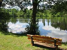
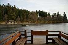
The area of the lake, which lies at a height of 914 metres above sea level immediately north of the Schlüchtsee farm between Grafenhausen and Rothaus,[2] is about 6 ha (0.06 km²) and it has a shoreline just under 0.73 kilometres long. It is 260 metres across from north to south and 230 metres from east to west. It is up to 5 metres deep.[3] The lake is popular for bathing and angling. A path runs past the lake to the Hüsli, named after Klausjürgen Wussow. The lake is part of a nature reserve, no. 3,032 covering 8.5 ha and known as the "Schlüchtsee", that was established on 11 October 1940.
References
- ↑ Stephan Elsemann (2016-08-14). "Refugium für Seerosen" (PDF) (in German). Der Sonntag, p. 4. Retrieved 2016-08-17.
- ↑ Gutachten von 1990 zur geplanten Erweiterung des Naturschutzgebietes
- ↑ Information about the Schlüchtsee
Literature
External links
| Wikimedia Commons has media related to Schlüchtsee. |
- Fact file of the Nature Reserve in the index of protected areas published by the Baden-Württemberg Office for the Environment, Survey and Conservation (Landesanstalt für Umwelt, Messungen und Naturschutz Baden-Württemberg)