Schöneseiffen
| Schöneseiffen | |
|---|---|
| Stadt of Schleiden | |
 Schöneseiffen | |
| Coordinates: 50°31′10″N 6°23′47″E / 50.519444°N 6.396389°ECoordinates: 50°31′10″N 6°23′47″E / 50.519444°N 6.396389°E | |
| Country | Germany |
| State | North Rhine-Westphalia |
| Municipality | Schleiden |
| Elevation | 585 m (1,919 ft) |
| Population (2015-10-31) | |
| • Total | 415 |
| Time zone | CET/CEST (UTC+1/+2) |
| Postal codes | 53937 |
| Dialling codes | 02485 |
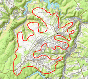
Schöneseiffen is a village southwest of Schleiden in the county of Euskirchen| in the German state of North Rhine-Westphalia. The Dieffenbach stream rises north of the village. Schöneseiffen has a population of about 415.[1] Schöneseiffen has sports field, a Bürgerhaus and a youth centre.
Schleiden-Schöneseiffen Wind Farm
To the west, on the B 258, is the Schleiden-Schöneseiffen wind park with 18 wind turbines. In 2014–2015, 12 of the 17 generators underwent a repowering from the Tacke TW 1.5 and were replaced by 13 Enercon E-101s.[2] Together with the remaining Enercon E-82 E2s and the remaining five Tacke TW 1.5 MW turbines the wind farm has a total capacity of 49.45 MW, making it one of the seven largest in North Rhine-Westphalia.
Geography
Schöneseiffen lies in North Rhine-Westphalia in der Rur Eifel region, west of the town of Schleiden, not far from the Belgian border on the Dreiborn Plateau[3] above the valley of the Olef. In the parish of Schöneseiffen is the Hollerscheid, the highest point on the Dreiborn Plateau, 622.7 metres above sea level (NHN).
History
Schöneseiffen is first recorded on 19 October 1322 along with Bronsfeld and Harperscheid.
In accordance with § 9 of the 1971 Aachen Act, the village was incorporated into the borough of Schleiden on 1 January 1972.[4]
Nature and local recreation
The highland area is attractive to tourists with its long views over the valley of the Olef, the nearby Eifel National Park and the Dreiborn Plateau. Its proximity to the Olef Reservoir and the Hellenthal Wildlife Enclosure and the extensive network of waymarked trails also make it popular.
Transport
The B 258 runs through Schöneseiffen. The nearest motorway junctions are Nettersheim on the A 1, Aachen-Lichtenbusch on the A 44 and Wißkirchen on the A 1
References
- ↑ Bevölkerungsstatistik Stadt Schleiden Archived 2016-03-04 at the Wayback Machine. (pdf; 14 kB)
- ↑ Franz Albert Heinen (2015-03-10). "60 Millionen-Investition in Windpark Schleiden". Kölner Stadt-Anzeiger (in German). Retrieved 2015-05-11.
- ↑ Ewald Gläßer (1978), Bundesforschungsanstalt für Landeskunde und Raumordnung, ed., [online, PDF "Die naturräumlichen Einheiten auf Blatt 122/123 Köln Aachen"] (in German), Geographische Landesaufnahme 1:200000 Naturräumliche Gliederung Deutschland (Bad Godesberg: Selbstverlag), online, PDF. Retrieved 2016-02-16
- ↑ Statistisches Bundesamt, ed. (1983). Historisches Gemeindeverzeichnis für die Bundesrepublik Deutschland. Namens-, Grenz- u. Schlüsselnummernänderungen bei Gemeinden, Kreisen u. Reg.-Bez. vom 27.5.1970 bis 31.12.1982. Stuttgart/Mainz: Kohlhammer. p. 309. ISBN 3-17-003263-1. record:.
External links
Borough of Schleiden | ||
|---|---|---|
|  | |