Savelugu-Nanton District
| Savelugu-Nanton District | |
|---|---|
| District | |
 Districts of Northern region | |
 Savelugu-Nanton District Savelugu-Nanton District in Northern region | |
| Coordinates: 9°24′N 0°28′W / 9.400°N 0.467°W | |
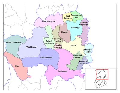
| Region | Northern Region |
| Capital | Savelugu |
| Government | |
| • District executive | Abdullah Red |
| Area | |
| • Total | 1,790 km2 (690 sq mi) |
| Population (2013) | |
| • Total | — |
| Time zone | UTC+0 (Greenwich Mean Time) |
| • Summer (DST) | GMT |
| ISO 3166 code | GH-NP-SN |
Background
The Savelugu-Nanton District is one of the twenty (20) districts in the Northern Region of Ghana.[1] Its capital is Savelugu. The district has 149 communities of which five are area councils aside Savelugu being the capital. The area councils are Nanton, Pong-Tamale, Diare, Moglaa and Tampion. The population of this district according to the 2000 population census was 91,415 having a growth rate of 3%. 109,442 was the projected population as at March 2006 with its breakdown being 49% male and 51% female with a land area of 1790.7 km2.
Sources
External links
| Metropolitan |
| .svg.png) |
|---|---|---|
| Municipal |
| |
| District |
| |
This article is issued from
Wikipedia.
The text is licensed under Creative Commons - Attribution - Sharealike.
Additional terms may apply for the media files.