Sauyr Zhotasy
| Sauyr Zhotasy | |
|---|---|
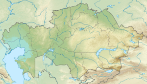 Sauyr Zhotasy Location in Kazakhstan (on the border with China) | |
| Highest point | |
| Elevation | 3,840 m (12,600 ft) [1] |
| Prominence |
3,252 m (10,669 ft) [1] Ranked 68th |
| Isolation | 287 kilometres (178 mi) |
| Listing | Ultra |
| Coordinates | 47°02′57″N 85°34′00″E / 47.04917°N 85.56667°ECoordinates: 47°02′57″N 85°34′00″E / 47.04917°N 85.56667°E [1] |
| Geography | |
| Location | China–Kazakhstan border |
| Parent range | Saur, Tien Shan |
| Climbing | |
| First ascent | Unclimbed |
Sauyr Zhotasy (Kazakh: Сауыр жотасы), also known as Muz Tau (Chinese: 木斯岛山; pinyin: Mùsīdǎo Shān), is the highest point in the Saur Range, and of the entire Saur-Tarbagatai mountain system, part of the Tien Shan, on the border between Kazakhstan and China. It lies 100 kilometres (60 mi) southeast of Zaysan Lake. Despite its low elevation, it is well separated from higher ranges in its area (the Saur-Tarbagatai System being separated from the Altai Mountains by the Irtysh River valley, and from the Dzungarian Alatau, by the Dzungarian Gate); it is therefore ranked highly by topographic prominence.
No recorded ascents have come to light and it is potentially one of the most prominent unclimbed peaks.
See also
References
- 1 2 3 "The Central Asian Republics: Ultra-Prominence Page". Peaklist.org. Retrieved 2014-05-26.
External links
This article is issued from
Wikipedia.
The text is licensed under Creative Commons - Attribution - Sharealike.
Additional terms may apply for the media files.