Sauwald
| Sauwald | |
|---|---|
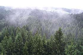 Mist rising from the Sauwald near Kopfing | |
| Highest point | |
| Peak | Haugstein |
| Elevation | 895 m (2,936 ft) |
| Dimensions | |
| Length | 40 km (25 mi) |
| Area | 460 km2 (180 sq mi) |
| Geography | |
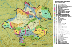 Upper Austrian regions
| |
| State | Districts of Schärding, Grieskirchen, Eferding (Innviertel); Upper Austria |
| Range coordinates | 48°30′32.5″N 13°40′12.9″E / 48.509028°N 13.670250°ECoordinates: 48°30′32.5″N 13°40′12.9″E / 48.509028°N 13.670250°E |
| Parent range | Granite and Gneiss Highland, Bohemian Massif |
| Geology | |
| Type of rock | Granite, covered by a marl platform in places |
The Sauwald in Upper Austria is the largest part of the Bohemian Massif lying south of the Danube. Its plateau runs from Passau and Schärding on the Inn to Eferding.
Origin of the name: Passau Forest
Folk etymologically the name is believed to have derived from the (formally native) wild boar, but the term is more probably an abbreviation of its old name, Passauer Wald ("Passau Forest"). The whole region was always closely linked to the Bishopric of Passau and the town of Passau.[1]
References
- ↑ Sauwald Erdäpfel. Entry No. 85 in the Register der Traditionellen Lebensmittel of the Austrian Ministry of Agriculture and Forestry, Environment and Water Management.
External links
- Regionalverband Sauwald
- Kulturprojekt Sauwald
- "Karte zur Raumeinheit Sauwald". DORIS (in German). Retrieved 2014-12-01.
- "Sauwald". Natur und Landschaft in Oberösterreich (in German). Retrieved 2014-12-01.
This article is issued from
Wikipedia.
The text is licensed under Creative Commons - Attribution - Sharealike.
Additional terms may apply for the media files.