Sasseneire
| Sasseneire | |
|---|---|
 From Pas de Lona (north side) | |
| Highest point | |
| Elevation | 3,254 m (10,676 ft) |
| Prominence | 386 m (1,266 ft) [1] |
| Parent peak | Monte Rosa |
| Coordinates | 46°08′19.1″N 7°31′31.4″E / 46.138639°N 7.525389°ECoordinates: 46°08′19.1″N 7°31′31.4″E / 46.138639°N 7.525389°E |
| Geography | |
 Sasseneire Location in Switzerland | |
| Location | Valais, Switzerland |
| Parent range | Pennine Alps |
The Sasseneire is a mountain of the Swiss Pennine Alps, overlooking Evolène in the canton of Valais. It lies on the range between the valleys of Hérens and Anniviers.
Climbing routes
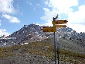
Normal mountaineering routes to Sasseneire are from Val de Moiry on the east and from Val d’Herens on the west. Both routes lead to Col de Torrent which is at 2916 m above the sea level. A very convenient start point is the dam at the Moiry lake, with the car access and with the bus service from Grimentz. You need 2.5 hours from the dam to the Col de Torrent.
From the Col you will need one hour to the summit. Just follow the ridge in the north direction. There are no exposed sections in any part of the route.
References
External links
- Sasseneire at mountainsforeverybody.com
This article is issued from
Wikipedia.
The text is licensed under Creative Commons - Attribution - Sharealike.
Additional terms may apply for the media files.