Sartilly
| Sartilly | |
|---|---|
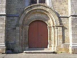 Romanesque doorway of the Saint-Pair church | |
 Sartilly Location within Normandy region  Sartilly | |
| Coordinates: 48°45′10″N 1°27′21″W / 48.7528°N 1.4558°WCoordinates: 48°45′10″N 1°27′21″W / 48.7528°N 1.4558°W | |
| Country | France |
| Region | Normandy |
| Department | Manche |
| Arrondissement | Avranches |
| Canton | Avranches |
| Intercommunality | Avranches - Mont-Saint-Michel |
| Government | |
| • Mayor (2008–2014) | Denis Rault |
| Area1 | 11.53 km2 (4.45 sq mi) |
| Population (2006)2 | 1,332 |
| • Density | 120/km2 (300/sq mi) |
| Demonym(s) | Sartillais |
| Time zone | UTC+1 (CET) |
| • Summer (DST) | UTC+2 (CEST) |
| INSEE/Postal code | 50565 /50530 |
| Elevation |
35–119 m (115–390 ft) (avg. 107 m or 351 ft) |
|
1 French Land Register data, which excludes lakes, ponds, glaciers > 1 km2 (0.386 sq mi or 247 acres) and river estuaries. 2 Population without double counting: residents of multiple communes (e.g., students and military personnel) only counted once. | |
Sartilly is a former commune in the Manche department in Normandy in north-western France. On 1 January 2016, it was merged into the new commune of Sartilly-Baie-Bocage.[1]
See also
References
- ↑ Arrêté préfectoral 14 December 2015 (in French)
| Wikimedia Commons has media related to Sartilly. |
This article is issued from
Wikipedia.
The text is licensed under Creative Commons - Attribution - Sharealike.
Additional terms may apply for the media files.