Sarroux
| Sarroux | |
|---|---|
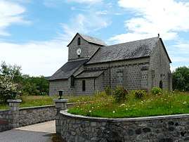 The church in Sarroux | |
 Sarroux Location within Nouvelle-Aquitaine region  Sarroux | |
| Coordinates: 45°24′52″N 2°25′54″E / 45.4144°N 2.4317°ECoordinates: 45°24′52″N 2°25′54″E / 45.4144°N 2.4317°E | |
| Country | France |
| Region | Nouvelle-Aquitaine |
| Department | Corrèze |
| Arrondissement | Ussel |
| Canton | Haute-Dordogne |
| Area1 | 23.76 km2 (9.17 sq mi) |
| Population (2008)2 | 443 |
| • Density | 19/km2 (48/sq mi) |
| Time zone | UTC+1 (CET) |
| • Summer (DST) | UTC+2 (CEST) |
| INSEE/Postal code | 19252 /19110 |
|
1 French Land Register data, which excludes lakes, ponds, glaciers > 1 km2 (0.386 sq mi or 247 acres) and river estuaries. 2 Population without double counting: residents of multiple communes (e.g., students and military personnel) only counted once. | |
Sarroux is a former commune in the Corrèze department in central France. On 1 January 2017, it was merged into the new commune Sarroux-Saint Julien.[1]
Population
| Historical population | ||
|---|---|---|
| Year | Pop. | ±% |
| 1962 | 451 | — |
| 1968 | 426 | −5.5% |
| 1975 | 375 | −12.0% |
| 1982 | 361 | −3.7% |
| 1990 | 362 | +0.3% |
| 1999 | 379 | +4.7% |
| 2008 | 443 | +16.9% |
See also
References
- ↑ Arrêté préfectoral 22 June 2016 (in French)
| Wikimedia Commons has media related to Sarroux. |
This article is issued from
Wikipedia.
The text is licensed under Creative Commons - Attribution - Sharealike.
Additional terms may apply for the media files.