Saranac, Michigan
| Saranac, Michigan | |
|---|---|
| Village | |
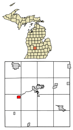 Location of Saranac, Michigan | |
| Coordinates: 42°55′47″N 85°12′43″W / 42.92972°N 85.21194°W | |
| Country | United States |
| State | Michigan |
| County | Ionia |
| Area[1] | |
| • Total | 1.20 sq mi (3.11 km2) |
| • Land | 1.15 sq mi (2.98 km2) |
| • Water | 0.05 sq mi (0.13 km2) |
| Elevation | 646 ft (197 m) |
| Population (2010)[2] | |
| • Total | 1,325 |
| • Estimate (2016)[3] | 1,335 |
| • Density | 1,100/sq mi (430/km2) |
| Time zone | UTC-5 (Eastern (EST)) |
| • Summer (DST) | UTC-4 (EDT) |
| ZIP code | 48881 |
| Area code(s) | 616 |
| FIPS code | 26-71660[4] |
| GNIS feature ID | 0637257[5] |
| Website | villageofsaranacmi.org |
Saranac is a village in Ionia County in the U.S. state of Michigan. The population was 1,325 at the 2010 census. Today, Saranac serves as a retail and service center for agricultural areas surrounding the village.
Saranac is the birthplace of world-renowned geologist J Harlen Bretz.
Geography and Landscape
According to the United States Census Bureau, the village has a total area of 1.20 square miles (3.11 km2), of which 1.15 square miles (2.98 km2) is land and 0.05 square miles (0.13 km2) is water.[1] The village is located along the Grand River Valley, within a deep glacial drainage channel and is intersected by the Grand River. The landscape itself is dominated by dense forest, and sprawling, open farmland. The forest is closely associated with the basin of the Grand River and its floodplanes and wetlands. However, wetlands have dwindled over the years, due to drainage and filling in order to improve agricultural opportunities within the region. This is not atypical within the state of Michigan, despite the vast ecological importance that Michigan's wetlands possess.[6]
History

Saranac had its roots in 1836, when a Grand Rapids judge by the name of Jefferson Morrison purchased the land where Lake Creek meets the Grand River. Soon after, he sold parts of the land to Dwight & Hutchinson from Detroit, and together, they founded the village. Proceeding quickly, the proprietors named it Saranac and held a public sale in Detroit. There they sold off many Saranac lots without doing much to ensure the integrity of their original records. Soon after, Dwight & Hutchinson became concerned over the lack of devolpement of the village by the lot-purchasers and gave Cyprian S. Hooker land on which to build a saw mill. Construction began in 1837, but didn't see completion until 1841. Partnering with a furniture maker named Jerry Stocking, the two set out to make their fortunes in the new village. However, they did not find success. In 1846, the gentlemen gave up and moved away. Other villagers also followed suit- convinced the village was doomed. In 1847 a merchant named Ammon Wilson moved in and set up shop on Stocking's former property and later built a warehouse to ship wheat to Grand Rapids, which saw considerable success The village grew around it; A tavern and a hotel soon followed. In 1851, proprietors of the sold-off lots were allowed to re-dub the township "Boston", due to an oversight in Dwight & Hutchinson's records and it wouldn't be until 1859 that popular demand would see the name changed back to "Saranac".[7] Schools, stores, and churches, followed in the subsequent years. In 1857, the first train to reach Saranac rolled through, marking a significant period of growth for the Village.[8]
Government
Saranac is a General Law village with an elected council consisting of a president, clerk, treasurer, and six trustees[9]
Demographics
| Historical population | |||
|---|---|---|---|
| Census | Pop. | %± | |
| 1870 | 724 | — | |
| 1880 | 877 | 21.1% | |
| 1890 | 790 | −9.9% | |
| 1900 | 768 | −2.8% | |
| 1910 | 845 | 10.0% | |
| 1920 | 750 | −11.2% | |
| 1930 | 729 | −2.8% | |
| 1940 | 849 | 16.5% | |
| 1950 | 885 | 4.2% | |
| 1960 | 1,081 | 22.1% | |
| 1970 | 1,223 | 13.1% | |
| 1980 | 1,421 | 16.2% | |
| 1990 | 1,461 | 2.8% | |
| 2000 | 1,326 | −9.2% | |
| 2010 | 1,325 | −0.1% | |
| Est. 2016 | 1,335 | [3] | 0.8% |
| U.S. Decennial Census[10] | |||
2010 census
As of the census[2] of 2010, there were 1,325 people, 573 households, and 339 families residing in the village. The population density was 1,152.2 inhabitants per square mile (444.9/km2). There were 616 housing units at an average density of 535.7 per square mile (206.8/km2). The racial makeup of the village was 97.4% White, 0.2% African American, 0.2% Native American, 0.4% Asian, 0.8% from other races, and 1.1% from two or more races. Hispanic or Latino of any race were 2.7% of the population.
There were 573 households of which 33.3% had children under the age of 18 living with them, 42.2% were married couples living together, 12.6% had a female householder with no husband present, 4.4% had a male householder with no wife present, and 40.8% were non-families. 36.5% of all households were made up of individuals and 15.9% had someone living alone who was 65 years of age or older. The average household size was 2.31 and the average family size was 3.01.
The median age in the village was 37.2 years. 28% of residents were under the age of 18; 6.8% were between the ages of 18 and 24; 24.2% were from 25 to 44; 25.8% were from 45 to 64; and 15.1% were 65 years of age or older. The gender makeup of the village was 47.6% male and 52.4% female.
2000 census
As of the census[4] of 2000, there were 1,326 people, 568 households, and 348 families residing in the village. The population density was 1,142.1 per square mile (441.4/km²). There were 589 housing units at an average density of 507.3 per square mile (196.0/km²). The racial makeup of the village was 98.11% White, 0.08% African American, 0.08% Native American, 0.30% Asian, 0.08% Pacific Islander, 0.68% from other races, and 0.68% from two or more races. Hispanic or Latino of any race were 1.36% of the population.
There were 568 households out of which 32.0% had children under the age of 18 living with them, 46.1% were married couples living together, 12.1% had a female householder with no husband present, and 38.6% were non-families. 35.9% of all households were made up of individuals and 20.2% had someone living alone who was 65 years of age or older. The average household size was 2.33 and the average family size was 3.03.
In the village, the population was spread out with 27.0% under the age of 18, 8.2% from 18 to 24, 26.3% from 25 to 44, 20.5% from 45 to 64, and 17.9% who were 65 years of age or older. The median age was 37 years. For every 100 females, there were 82.4 males. For every 100 females age 18 and over, there were 73.8 males.
The median income for a household in the village was $31,350, and the median income for a family was $41,250. Males had a median income of $35,221 versus $24,750 for females. The per capita income for the village was $15,867. About 5.9% of families and 11.3% of the population were below the poverty line, including 12.5% of those under age 18 and 17.4% of those age 65 or over.
References
- 1 2 "US Gazetteer files 2010". United States Census Bureau. Archived from the original on 2012-01-24. Retrieved 2012-11-25.
- 1 2 "American FactFinder". United States Census Bureau. Retrieved 2012-11-25.
- 1 2 "Population and Housing Unit Estimates". Retrieved June 9, 2017.
- 1 2 "American FactFinder". United States Census Bureau. Retrieved 2008-01-31.
- ↑ U.S. Geological Survey Geographic Names Information System: Saranac, Michigan
- ↑ "Village of Saranac Ionia County, Michigan 5-Year Park and Recreation Plan 2018-2022" (PDF)
|format=requires|url=(help). Missing or empty|url=(help);|access-date=requires|url=(help) - ↑ "Welcome to Boston Township". Boston Township.
- ↑ "Saranac enjoys peace, quiet and a sense of history along Grand River". MLive Media Group. Retrieved 2018-04-13.
- ↑ "Village Details". VillageofSaranacMI.org. Retrieved 2018-04-13.
- ↑ "Census of Population and Housing". Census.gov. Retrieved June 4, 2015.
External links
Municipalities and communities of Ionia County, Michigan, United States | ||
|---|---|---|
| Cities | 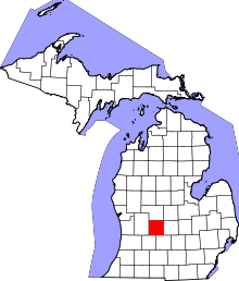 | |
| Villages | ||
| Townships | ||
| Footnotes | ‡This populated place also has portions in an adjacent county or counties | |
Coordinates: 42°55′46″N 85°12′47″W / 42.92944°N 85.21306°W