Saoner
| Saoner सावनेर Saraswatpur, Savner | |
|---|---|
| SCB Town | |
 Saoner Location in Maharashtra, India | |
| Coordinates: 21°23′09″N 78°55′12″E / 21.3858107°N 78.9201379°ECoordinates: 21°23′09″N 78°55′12″E / 21.3858107°N 78.9201379°E | |
| Country |
|
| State | Maharashtra |
| District | Nagpur |
| Government | |
| • Body | Nagar Parisad, Saoner |
| Area rank | 5th |
| Population (2011) | |
| • Total | 42,000 |
| • Rank | 5th |
| Languages | |
| • Official | Marathi |
| Time zone | UTC+5:30 (IST) |
| PIN | 441107 |
| Telephone code | 07113 |
| Vehicle registration | MH-40 |
| Nearest city | Nagpur |
| Literacy | 89% |
| Vidhan Sabha constituency | Saoner |
| Climate | Healthy (Köppen) |
| Website |
www |
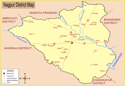
Saoner is a town and tehsil headquarters in north part of Nagpur district in state of Maharashtra, India. The town is governed by Saoner municipal council.[1] It is 36 kilometres (22 mi) from Nagpur city. Saoner is located on the bank of Kolar River.
History
Saoner is said to be mentioned in the Jaimini Ashwamedh under the name of Saraswatpur, and there are many legends connected with it. Ancient Shiv temple also known as Hemdapanti Shiv temple is also located near the bank of Kolar river. It is believed that while worshiping the Lord Shiva the flow of Kolar river was bent to form OM shape. This OM shape of Kolar river can be easily seen by satellite image. Ancient temple of Lord Ganesh is located at the neighboring village of Adasa on a hill. Saoner is also of historic importance due to its role in the 1942 Quit India Movement against the British.
Demographics
As of 2011 India census,[2] the town of Saoner had a population of 42,000. Males constituted 51% of the population and females 49%. Saoner had an average literacy rate of 89%, higher than the national average of 59.5%: male literacy was 89%, and female literacy was 88%. In Saoner, 14% of the population was under 6 years of age.
Climate
Saoner has tropical wet and dry climate (Köppen climate classification) with dry conditions prevailing for most of the year. It receives about 163 mm of rainfall in June. The amount of rainfall is increased in July to 294 mm. Gradual decrease of rainfall has been observed from July to August (278 mm) and September (160 mm).[3] The highest recorded daily rainfall was 304 mm on 14 July 1994. Summers are extremely hot, lasting from March to June, with May being the hottest month. Winter lasts from November to January, during which temperatures drop below 10 °C (50 °F).[3] The highest recorded temperature in the city was 48 °C on 19 May 2015, while the lowest was 3.9 °C.
| Climate data for Nagpur Airport (1971–1990) | |||||||||||||
|---|---|---|---|---|---|---|---|---|---|---|---|---|---|
| Month | Jan | Feb | Mar | Apr | May | Jun | Jul | Aug | Sep | Oct | Nov | Dec | Year |
| Record high °C (°F) | 36.6 (97.9) |
39.2 (102.6) |
45.0 (113) |
46.1 (115) |
47.8 (118) |
47.7 (117.9) |
40.6 (105.1) |
37.8 (100) |
38.9 (102) |
39.5 (103.1) |
35.6 (96.1) |
39.7 (103.5) |
47.8 (118) |
| Average high °C (°F) | 28.7 (83.7) |
31.2 (88.2) |
36.2 (97.2) |
40.7 (105.3) |
42.4 (108.3) |
37.5 (99.5) |
31.6 (88.9) |
30.5 (86.9) |
32.3 (90.1) |
32.7 (90.9) |
30.4 (86.7) |
28.1 (82.6) |
33.5 (92.3) |
| Daily mean °C (°F) | 20.8 (69.4) |
23.2 (73.8) |
27.7 (81.9) |
32.5 (90.5) |
35.1 (95.2) |
31.9 (89.4) |
27.9 (82.2) |
27.1 (80.8) |
27.7 (81.9) |
26.4 (79.5) |
23.0 (73.4) |
20.4 (68.7) |
27.0 (80.6) |
| Average low °C (°F) | 12.9 (55.2) |
15.1 (59.2) |
19.2 (66.6) |
24.3 (75.7) |
27.8 (82) |
26.3 (79.3) |
24.1 (75.4) |
23.6 (74.5) |
23.1 (73.6) |
20.0 (68) |
15.5 (59.9) |
12.6 (54.7) |
20.4 (68.7) |
| Record low °C (°F) | 3.9 (39) |
5.0 (41) |
8.3 (46.9) |
13.9 (57) |
19.4 (66.9) |
20.0 (68) |
19.4 (66.9) |
18.3 (64.9) |
16.6 (61.9) |
11.6 (52.9) |
6.7 (44.1) |
5.5 (41.9) |
3.9 (39) |
| Average precipitation mm (inches) | 12.5 (0.492) |
20.7 (0.815) |
17.6 (0.693) |
14.3 (0.563) |
19.2 (0.756) |
190.1 (7.484) |
341.7 (13.453) |
280.5 (11.043) |
183.1 (7.209) |
56.8 (2.236) |
16.6 (0.654) |
13.2 (0.52) |
1,166.3 (45.917) |
| Average rainy days (≥ 1.0 mm) | 1.8 | 2.2 | 1.9 | 1.2 | 2.9 | 11.4 | 17.5 | 16.5 | 10.4 | 4.0 | 1.3 | 1.1 | 72.2 |
| Average relative humidity (%) | 54 | 43 | 30 | 24 | 27 | 55 | 77 | 80 | 74 | 61 | 55 | 56 | 53 |
| Mean monthly sunshine hours | 272.0 | 268.3 | 287.6 | 290.8 | 293.8 | 186.6 | 115.4 | 116.7 | 182.5 | 260.4 | 264.1 | 268.8 | 2,807 |
| Source #1: NOAA[4] | |||||||||||||
| Source #2: India Meteorological Department (record high and low up to 2010)[6] | |||||||||||||
Extreme Weather
The average number of Heat wave days occurring in Saoner in the Summer months of March, April & May is 0.5, 2.4 and 7.2 days respectively. May is the most uncomfortable and hottest month with, for example, 18 days of heat waves being experienced in 1973, 1988 and 2010. The summer season is characterized by other severe weather activity like thunderstorms, dust storms, hailstorms and squalls. Generally, hailstorms occur during March and dust storms during March and April. These occur infrequently (0.1 per day). Squalls occur more frequently with 0.3 per day in March and April rising to 0.8 per day in May.[3]
Culture
The city of Saoner has a rich Culture in Vidarbha. Co-existence of communal harmony is an excellent example in Saoner, wherein people of all caste come together to celebrate Pola (Festival of Bullocks), Eid, Christmas, Holi and Diwali. Famous Marathi writer Ram Ganesh Gadkari was died here.
Economy
coal mines, textile and paper industry, are the financial growth drivers. The primary occupation of its people is farming. Saoner is part of Ramtek (Lok Sabha constituency). The local language is Marathi and Hindi. Most of the bridges and government buildings were built by the British Government in the late 1930s. WCL (Western Coalfields India Limited) has open cast and closed coal mines, coal is mined and transported with the help of railway wagons to Khaparkheda Thermal Powerhouse. Weekly market is held on Fridays.
Transportation
Saoner is well connected to Nagpur by road. Saoner was connected by narrow gauge railway which was disconnected since 2015 as broad gauge conversion work started between Nagpur and Chhindwara. It is expected to be finished by the end of 2020. From 2015 Indian Railways has started constructing a dedicated railway link from Saoner to Nagpur, Chhindwara,.Jabalpur. State Government of Maharashtra and Madhya Pradesh operate stage carrier bus service, besides private taxis and autos. The iconic NH 69 passes via Saoner.
References
- ↑ "Administrative divisions of Nagpur district". National Informatic Center. Government of Maharashtra. Archived from the original on 10 April 2009. Retrieved 2009-01-09.
- ↑ "Census of India 2011: Data from the 2011 Census, including cities, villages and towns (Provisional)". Census Commission of India. Archived from the original on 2004-06-16. Retrieved 2008-11-01.
- 1 2 3 http://imdnagpur.gov.in/Climate_NGP.pdf
- ↑ "Nagpur/Sonegaon Climate Normals 1971–1990". National Oceanic and Atmospheric Administration. Retrieved 17 April 2015.
- ↑ https://web.archive.org/web/20150413020426/http://www.imd.gov.in/doc/climateimp.pdf
- ↑ "Ever recorded Maximum and minimum temperatures up to 2010" (PDF). India Meteorological Department. Archived from the original (PDF) on 21 May 2013. Retrieved 17 April 2015.
Places adjacent to Saoner | ||||||||||
|---|---|---|---|---|---|---|---|---|---|---|
| ||||||||||