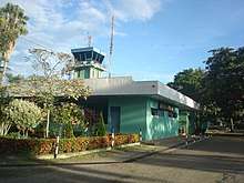
Santiago Vila Airport
| Santiago Vila Airport Aeropuerto Santiago Vila | |||||||||||
|---|---|---|---|---|---|---|---|---|---|---|---|
 | |||||||||||
| Summary | |||||||||||
| Airport type | Public | ||||||||||
| Serves | Girardot, Colombia | ||||||||||
| Location | Flandes, Colombia | ||||||||||
| Elevation AMSL | m / 900 ft | ||||||||||
| Coordinates | 4°16′35″N 74°47′46″W / 4.27639°N 74.79611°W | ||||||||||
| Map | |||||||||||
 GIR Location of the airport in Colombia | |||||||||||
| Runways | |||||||||||
| |||||||||||
| Statistics (2009) | |||||||||||
| |||||||||||
Santiago Vila Airport (Spanish: Aeropuerto Santiago Vila) (IATA: GIR, ICAO: SKGI) is an airport serving Girardot, a city in the Cundinamarca Department of Colombia. The airport is 3.1 kilometres (2 mi) south of Girardot, across the Magdalena River by the town of Flandes in the Tolima Department.
The Girardot VOR-DME (Ident: GIR) is 6.5 nautical miles (12.0 km) southwest of the airport.[4]
Accidents and incidents
On 12 December 1982, Douglas C-47A HK-2580 of Transportes Aéreas Latinamericas crashed at Santiago Vila Airport while on a training flight destined to land at Mariquita Airport. One of the four people on board was killed.[5]
See also


- Transport in Colombia
- List of airports in Colombia
References
- ↑ Airport information for SKGI from DAFIF (effective October 2006)
- ↑ Airport information for GIR at Great Circle Mapper.
- ↑ Google Maps - Girardot
- ↑ Girardot VOR
- ↑ "HK-2580 Accident report". Aviation Safety Network. Retrieved 13 July 2010.
External links
This article is issued from
Wikipedia.
The text is licensed under Creative Commons - Attribution - Sharealike.
Additional terms may apply for the media files.