Santa Teresa, Uruguay
| Santa Teresa | |
|---|---|
| Suburb of Rivera | |
 Santa Teresa Location in Uruguay | |
| Coordinates: 30°55′0″S 55°35′0″W / 30.91667°S 55.58333°WCoordinates: 30°55′0″S 55°35′0″W / 30.91667°S 55.58333°W | |
| Country |
|
| Department | Rivera Department |
| Population (2011) | |
| • Total | 2,657 |
| Time zone | UTC -3 |
| Postal code | 40000 |
| Dial plan | +598 462 (+5 digits) |
Santa Teresa is a suburb of Rivera, the capital city of the Rivera Department of northeastern Uruguay.
Location and geography
The suburb is located on Avenida Italia, southwest of the city and northwest of the suburb Mandubí. The stream Arroyo Sauzal flows along the western limits of the suburb.
Population
In 2011 Santa Teresa had a population of 2,657.[1]
| Year | Population |
|---|---|
| 1975 | 162 |
| 1985 | 1,221 |
| 1996 | 1,793 |
| 2004 | 2,171 |
| 2011 | 2,657 |
Source: Instituto Nacional de Estadística de Uruguay[2]
References
- ↑ "Censos 2011 Cuadros Rivera". INE. 2012. Archived from the original on 23 November 2012. Retrieved 25 August 2012.
- ↑ "1963–1996 Statistics / S" (DOC). Instituto Nacional de Estadística de Uruguay. 2004. Retrieved 9 July 2011.
External links
Capital: Rivera | ||
| Towns and villages | 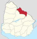 | |
| Sights | ||
This article is issued from
Wikipedia.
The text is licensed under Creative Commons - Attribution - Sharealike.
Additional terms may apply for the media files.