Santa Maria Airport (Sergipe)
| Aracaju–Santa Maria Airport Aeroporto Aracaju–Santa Maria | |||||||||||
|---|---|---|---|---|---|---|---|---|---|---|---|
 | |||||||||||
| Summary | |||||||||||
| Airport type | Public | ||||||||||
| Operator | Infraero | ||||||||||
| Serves | Aracaju | ||||||||||
| Elevation AMSL | 7 m / 23 ft | ||||||||||
| Coordinates | 10°59′07″S 037°04′24″W / 10.98528°S 37.07333°WCoordinates: 10°59′07″S 037°04′24″W / 10.98528°S 37.07333°W | ||||||||||
| Website | Infraero AJU | ||||||||||
| Map | |||||||||||
 AJU Location in Brazil | |||||||||||
| Runways | |||||||||||
| |||||||||||
| Statistics (2016) | |||||||||||
| |||||||||||
Aracaju–Santa Maria Airport (IATA: AJU, ICAO: SBAR) is the airport serving Aracaju, Brazil and it is operated by Infraero.
History
Although it had been in operation since the beginning of the 1950s, the official inauguration of the airport took place on 19 January 1958.
In 1961 began the first renovation of the airport complex, with an extension of the runway and enlargement of the passenger terminal.
In 1975 Infraero became the administrator of the airport, which later invested in further extension of the runway (completed in 1993) and in great enlargement of the passenger terminal (completed in 1998).
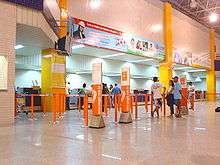
In 2012 the airport has already started the last extension through the construction of a completely new passenger terminal which will double its capacity.[4]
.jpg)
.jpg)
Airlines and destinations
Accidents and incidents
- 12 July 1951: a Lóide Aéreo Nacional Douglas DC-3/C-47 registration PP-LPG, still registered under Linhas Aéreas Paulistas – LAP, flying from Maceió to Aracaju, after aborting a landing in adverse conditions in Aracaju, overflew the runway and initiated a turn in low altitude to the right. The aircraft crashed during this turn. All 33 passengers and crew died, including the Governor of the state of Rio Grande do Norte Jerônimo Dix-sept Rosado Maia.[5][6]
Access
The airport is located 12 kilometres (7.5 mi) from downtown Aracaju and 3.5 kilometres (2.2 mi) from Atalaia Beach.
See also
References
- ↑ "Estatísticas" (in Portuguese). Infraero. Archived from the original on 23 April 2017. Retrieved 23 April 2017.
- ↑ "Airport Official Website" (in Portuguese). Infraero. Archived from the original on 24 September 2016.
- ↑ "Lista de aeródromos públicos" (in Portuguese). ANAC.
- ↑ "Aracaju airport has already have a schedule to initiate its extension". Sergipe news agency. Archived from the original on 19 September 2012. Retrieved 30 January 2012.
- ↑ "Accident description PP-LPG". Aviation Safety Network. Retrieved 12 August 2011.
- ↑ Germano da Silva, Carlos Ari César (2008). "Linhas Aéreas Paulistas". O rastro da bruxa: história da aviação comercial brasileira no século XX através dos seus acidentes 1928–1996 (in Portuguese) (2 ed.). Porto Alegre: EDIPUCRS. pp. 108–111. ISBN 978-85-7430-760-2.
| Wikimedia Commons has media related to Santa Maria Airport (Sergipe). |
External links
- Airport information for SBAR at World Aero Data. Data current as of October 2006.Source: DAFIF.
- Airport information for SBAR at Great Circle Mapper. Source: DAFIF (effective October 2006).
- Current weather for SBAR at NOAA/NWS
- Accident history for AJU at Aviation Safety Network