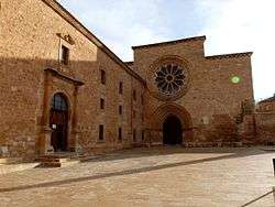
Santa María de Huerta
| Santa María de Huerta | ||
|---|---|---|
| Municipality | ||
 | ||
| ||
 Santa María de Huerta Location of Santa María de Huerta within Spain / Castile and León 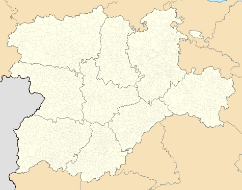 Santa María de Huerta Santa María de Huerta (Castile and León) Santa María de Huerta Santa María de Huerta (Europe) | ||
| Coordinates: 41°15′53″N 2°10′33″W / 41.26472°N 2.17583°WCoordinates: 41°15′53″N 2°10′33″W / 41.26472°N 2.17583°W | ||
| Country |
| |
| Autonomous Community |
| |
| Province | Soria | |
| Comarca | Campo de Gómara | |
| Government | ||
| • Type | Mayor-council government | |
| • Body | Ayuntamiento de Santa María de Huerta | |
| • Mayor | Mercedes Aguilar Medina (2015) (AISMH) | |
| Area | ||
| • Total | 49.15 km2 (18.98 sq mi) | |
| Elevation | 762 m (2,500 ft) | |
| Population (2016) INE | ||
| • Total | 300 | |
| • Density | 6.1/km2 (16/sq mi) | |
| Demonym(s) | Hortense, -sa (es) | |
| Time zone | CET (GMT +1) | |
| • Summer (DST) | CEST (GMT +2) | |
| Postcode | 42260 | |

Santa María de Huerta is a municipality located in the Campo de Gómara comarca, Province of Soria, Castile and León, Spain. According to the 2004 census (INE), the municipality has a population of 419 inhabitants.
This article is issued from
Wikipedia.
The text is licensed under Creative Commons - Attribution - Sharealike.
Additional terms may apply for the media files.