Sant Carles de Peralta
Coordinates: 39°02′02″N 1°33′54″E / 39.034°N 1.565°E
| Sant Carles de Peralta Sant Carles de Peralta | |
|---|---|
| Village | |
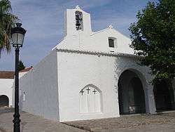 Church of Sant Carles | |
 Sant Carles de Peralta Location of the village of Sant Carles de Peralta | |
| Coordinates: 39°2′3″N 1°33′53″E / 39.03417°N 1.56472°E | |
| Country |
|
| Region | Balearic Islands |
| Population (2006) | |
| • Total | 3,195 |
| Time zone | UTC+1 (CET) |
| • Summer (DST) | UTC+2 (CEST) |
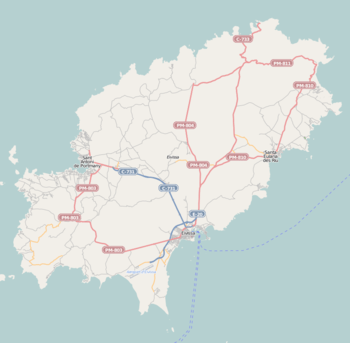
Sant Carles de Peralta (Spanish: San Carlos) is a village in the north east[1] of Ibiza (Catalan: Eivissa), Spain.[2] The village is in the municipality of Santa Eulària des Riu and is located on the designated road PM 810.[1] The village is 21.6 miles (34.8 km) North East of Ibiza Town and 28.3 miles (45.5 km) of Ibiza Airport. 5.0 kilometres (3.1 mi) to the South east of the village is the coastal resort of Es Canar.[3]
Locations
To the south of the village are chimneys and ruined buildings, the remains of lead mines first exploited by the Carthaginians. The church is worth a visit with an elegant arcaded entrance.[4] Next to it is the famous and historic Bar Anita, the original gathering place for hippies in the '60 of the last century.
References
- 1 2 "579 Regional Map, Spain, Islas Baleares. Pub:Michelin Editions des Voyages, 2004, ISBN 2-06-710098-X
- ↑ Ibiza & Formentera: 1:50000 (AA Island Maps). The Automobile Association. 2003-06-15. ISBN 978-0-7495-3783-8.
- ↑ The Rough Guide to Ibiza & Formentera. Pub:Rough Guides, Penguin Group, 2003, ISBN 1-84353-063-5
- ↑ Sale, Richard; Haydn Jones (2008-05-31). Ibiza & Formentera (AA Essential Spiral Guides). The Automobile Association. p. 190. ISBN 978-0-7495-5484-2.