Sannohe Station
Sannohe 三戸 | |
|---|---|
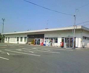 Sannohe Station in June 2007 | |
| Location |
Omukai, Nanbu-machi, Sannohe-gun, Aomori-ken 039-0103 Japan |
| Coordinates | 40°23′45″N 141°16′23″E / 40.395791°N 141.273153°E |
| Operated by |
|
| Line(s) | ■ Aoimori Railway Line |
| Distance | 5.5 km from Metoki |
| Platforms | 1 island + 1 side platform |
| Tracks | 3 |
| Connections | Bus stop |
| Construction | |
| Structure type | At grade |
| Other information | |
| Status | Staffed |
| Website | Official website |
| History | |
| Opened | September 1, 1898 |
| Location | |
 Sannohe Location within Japan | |
Sannohe Station (三戸駅 Sannohe-eki) is a railway station on the Aoimori Railway Line in the town of Nanbu, Aomori Prefecture, Japan, operated by the third sector railway operator Aoimori Railway Company.
Lines
Sannohe Station is served by the Aoimori Railway Line, and is 5.5 kilometers from the terminus of the line at Metoki Station. It is 622.8 kilometers from Tokyo Station.
Station layout
Sannohe Station has a one ground-level island platform and one ground-level side platform serving three tracks connected to the station building by a footbridge. However, only tracks 1 and 3 are in use, and track 2 is used as a siding. The station is staffed.
Platforms
| 1 | ■ Aoimori Railway Line | for Hachinohe and Aomori |
| 2 | ■ Aoimori Railway Line | (siding) |
| 3 | ■ Aoimori Railway Line | for Ninohe and Morioka |
- Note: Track 2 is used primarily for freight trains changing direction.
Adjacent stations
| ← | Service | → | ||
|---|---|---|---|---|
| Aoimori Railway Line | ||||
| Rapid: Does not stop at this station | ||||
| Metoki | local | Suwanotaira | ||
History
Sannohe Station was opened on September 1, 1898 as Sannohe Station (三ノ戸駅 Sannohe-eki) of the Nippon Railway. When the Nippon Railway was nationalized on November 1, 1906, it became a station of the Tōhoku Main Line on the Japan National Railways (JNR), and the kanji for its name was changed to the present configuration. Freight operations were discontinued from April 1962. With the privatization of the JNR on April 1, 1987, it came under the operational control of JR East. It came under the control of the Aoimori Railway Line on December 1, 2002.
Surrounding area
- Mabechi River
- former Nanbu Town Hall
- Sannohe Castle site
See also
External links
- Official website] (in Japanese)