Sankt Veit in Defereggen
| St. Veit in Defereggen | ||
|---|---|---|
| ||
 St. Veit in Defereggen Location within Austria
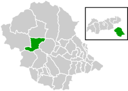
Location within Lienz district
| ||
| Coordinates: 46°55′32″N 12°25′33″E / 46.92556°N 12.42583°ECoordinates: 46°55′32″N 12°25′33″E / 46.92556°N 12.42583°E | ||
| Country | Austria | |
| State | Tyrol | |
| District | Lienz | |
| Government | ||
| • Mayor | Vitus Monitzer | |
| Area | ||
| • Total | 61.48 km2 (23.74 sq mi) | |
| Elevation | 1,495 m (4,905 ft) | |
| Population (1 January 2016)[1] | ||
| • Total | 693 | |
| • Density | 11/km2 (29/sq mi) | |
| Time zone | UTC+1 (CET) | |
| • Summer (DST) | UTC+2 (CEST) | |
| Postal code | 9962 | |
| Area code | 04879 | |
| Vehicle registration | LZ | |
| Website | Homepage der Gemeinde | |

Sankt Veit in Defereggen is a municipality in the district of Lienz in the Austrian state of Tyrol.
Geography
Sankt Veit lies in the central Defereggen valley and is the municipality in Eastern Tyrol with the highest elevation. It lies on the sunny side of the valley, and in the past grain and potatoes were raised there. However, there can be snowfall even in the summer months.
References
- ↑ Statistik Austria - Bevölkerung zu Jahresbeginn 2002-2016 nach Gemeinden (Gebietsstand 1.1.2016) for St. Veit in Defereggen.
External links
- Homepage der Gemeinde - town website
| Wikimedia Commons has media related to St. Veit in Defereggen. |
This article is issued from
Wikipedia.
The text is licensed under Creative Commons - Attribution - Sharealike.
Additional terms may apply for the media files.