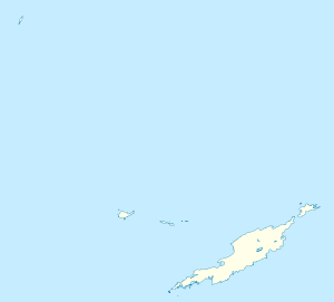
Sandy Ground, Anguilla
| Sandy Ground | |
|---|---|
| District | |
 | |
 Sandy Ground | |
| Coordinates: 18°12′0″N 63°5′0″W / 18.20000°N 63.08333°WCoordinates: 18°12′0″N 63°5′0″W / 18.20000°N 63.08333°W | |
| Country |
|
| Overesas Territory |
|
| Population (2001) | |
| • Total | 274 |
Sandy Ground is a village and one of the fourteen Districts of Anguilla, and its main port. The long curved beach is backed by high cliffs and a disused salt pond. According to the 2001 census Sandy Ground has a population of 274.[1]
Population
| Year | 1974 | 1984 | 1994 | 2001 |
|---|---|---|---|---|
| Population | 242 | 234 | 247 | 274 [2] |
References
- ↑ "Number of Dwellings and Persons for Censuses 1974 - 2001 (Table 2)". Statistics Department of Anguilla. Retrieved 2008-04-16.
- ↑ Anguilla census data at Statoids.com
External links
This article is issued from
Wikipedia.
The text is licensed under Creative Commons - Attribution - Sharealike.
Additional terms may apply for the media files.