Sandnes, Risør
| Sandnes | |
|---|---|
| Village | |
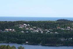 View of the village | |
 Sandnes Location of the village  Sandnes Sandnes (Norway) | |
| Coordinates: 58°41′26″N 9°09′35″E / 58.6906°N 09.1596°ECoordinates: 58°41′26″N 9°09′35″E / 58.6906°N 09.1596°E | |
| Country | Norway |
| Region | Southern Norway |
| County | Aust-Agder |
| District | Østre Agder |
| Municipality | Risør |
| Elevation[1] | 35 m (115 ft) |
| Time zone | UTC+01:00 (CET) |
| • Summer (DST) | UTC+02:00 (CEST) |
| Post Code | 4950 Risør |
Sandnes is a village in Risør municipality in Aust-Agder county, Norway. The village is located along the southern shore of the Sandnesfjorden, about 3 kilometres (1.9 mi) west of the village of Fie, about 4 kilometres (2.5 mi) north of the village of Nipe, and about 6 kilometres (3.7 mi) east of the village of Laget in Tvedestrand municipality.
References
- ↑ "Sandnes, Risør (Aust-Agder)". yr.no. Retrieved 2017-12-31.
This article is issued from
Wikipedia.
The text is licensed under Creative Commons - Attribution - Sharealike.
Additional terms may apply for the media files.