Sandberg, Bavaria
| Sandberg, Bavaria | ||
|---|---|---|
| ||
 Sandberg, Bavaria Location of Sandberg, Bavaria within Rhön-Grabfeld district 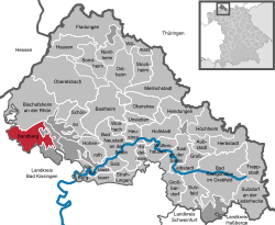 | ||
| Coordinates: 50°21′N 10°0′E / 50.350°N 10.000°ECoordinates: 50°21′N 10°0′E / 50.350°N 10.000°E | ||
| Country | Germany | |
| State | Bavaria | |
| Admin. region | Unterfranken | |
| District | Rhön-Grabfeld | |
| Government | ||
| • Mayor | Detlef Beinhauer (CSU) | |
| Area | ||
| • Total | 28.04 km2 (10.83 sq mi) | |
| Elevation | 452-542 m (−1,330 ft) | |
| Population (2017-12-31)[1] | ||
| • Total | 2,468 | |
| • Density | 88/km2 (230/sq mi) | |
| Time zone | CET/CEST (UTC+1/+2) | |
| Postal codes | 97657 | |
| Dialling codes | 09701 | |
| Vehicle registration | NES | |
| Website | www.sandberg-rhoen.de | |

Sandberg is a municipality in the district of Rhön-Grabfeld in Bavaria in Germany.
Geography
Location
Sandberg lies within the Main-Rhön regional planning region.
Subdivisions
Sandberg is divided into nine municipal subdivisions or villages:[2]
|
|
| Wikimedia Commons has media related to Sandberg (Lower Franconia). |
References
This article is issued from
Wikipedia.
The text is licensed under Creative Commons - Attribution - Sharealike.
Additional terms may apply for the media files.