Sand River (Limpopo)
| Sand River (Polokwane) | |
| Sandrivier | |
| River | |
| Name origin: Polokwane meaning "place of safety" in the Northern Sotho language.[1] | |
| Country | South Africa |
|---|---|
| State | Mpumalanga and Limpopo provinces |
| Tributaries | |
| - left | Mulaudzi (Blood), Hout, Moleletsane, Brak |
| - right | Diep, Koperspruit, Dwars |
| City | Polokwane |
| Landmark | Waterpoort (Soutpansberg) |
| Source | |
| - location | Yserberg |
| - elevation | 2,039 m (6,690 ft) |
| Mouth | Limpopo River |
| - location | near Musina |
| - elevation | 418 m (1,371 ft) |
| - coordinates | 22°18′50″S 30°7′41″E / 22.31389°S 30.12806°ECoordinates: 22°18′50″S 30°7′41″E / 22.31389°S 30.12806°E |
| Length | 350 km (217 mi) |
| Basin | 15,630 km2 (6,035 sq mi) |
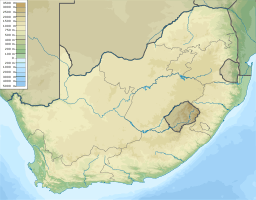 Location of the Sand River mouth | |
| [2] | |
The Sand River or Polokwane River[3] (Afrikaans: Sandrivier) is a watercourse in Limpopo Province, South Africa, a right hand tributary of the Limpopo River. Its new name "Polokwane River" is homonymous with the name of the town of Polokwane, formerly Pietersburg, about 200 kilometres (120 mi) upriver from its mouth. The Sand River flows by the western edge of this town.
Course
It has its source south of Mokopane and flows northwards across central Limpopo Province until it cuts across the Soutpansberg through a deep gorge, the Waterpoort. Then it meanders northwards across the Lowveld until it joins the right bank of the Limpopo 7 kilometres (4 mi) east of Musina.[4] Although considered a perennial stream it is often dry in the winter.
The veld in the Sand River basin has suffered much degradation, mainly due to overgrazing. There are some wetland zones in the basin. These areas are an important ecosystem for certain rare or endangered plants, as well as frog and bird species. There are 18 mines in the sand River basin.[5]
Dams and tributaries
The only relatively large dam in the Sand River basin is the Mathala Dam, also known as Houtrivier Dam, on the Hout River, a left hand tributary of the Sand.[6] The Diep River meets the right bank of the Sand River northeast of Polokwane town. The Mulaudzi River, also known as "Blood River", joins the Sand River from the left just north of Polokwane. The Seshego Dam is a small dam on the Mulaudzi.[7] The Brak River is an intermittent stream flowing between the Blouberg and the Soutpansberg, joining the left bank of the Sand River about 35 kilometres (22 mi) from the Limpopo River.
See also
References
- ↑ Meanings of place names in South Africa
- ↑ "State of Rivers Report - The Olifants River System". Council for Scientific and Industrial Research. Archived from the original on 2007-07-03. Retrieved 2009-02-19.
- ↑ Olifants River now called Lepelle
- ↑ Major rivers and streams within the Limpopo River Basin
- ↑ Sand Sub-basin
- ↑ Sand River
- ↑ Polokwane Municipality