Sand (municipality)
| Sand herad | |
|---|---|
| Former Municipality | |
 View of the village and municipality of Sand | |
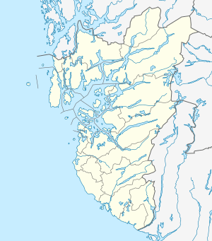 Sand herad Location in Rogaland county | |
| Coordinates: 59°29′12″N 06°15′04″E / 59.48667°N 6.25111°ECoordinates: 59°29′12″N 06°15′04″E / 59.48667°N 6.25111°E | |
| Country | Norway |
| Region | Western Norway |
| County | Rogaland |
| District | Ryfylke |
| Municipality ID | NO-1136 |
| Adm. Center | Sand |
| Area[1] | |
| • Total | 221 km2 (85 sq mi) |
| Time zone | UTC+01:00 (CET) |
| • Summer (DST) | UTC+02:00 (CEST) |
| Created from | Jelsa in 1859 |
| Merged into | Suldal in 1965 |
Sand is a former municipality in Rogaland county, Norway. The 221-square-kilometre (85 sq mi) municipality encompassed the area around the Hylsfjorden and the inner part of the Sandsfjorden. The administrative centre of the municipality was the village of Sand where Sand Church is located.[1]
History
The municipality was created in 1859 when the municipality of Jelsa was split in two. Initially, Sand had 1,600 inhabitants. On 1 January 1965, the municipality of Sand was dissolved due to the recommendations of the Schei Committee. Sand was incorporated into the neighboring municipality of Suldal along with Erfjord and parts of Imsland and Jelsa. Prior to the merger, Sand had 1,135 inhabitants.[2]
References
- 1 2 Store norske leksikon. "Sand – sogn" (in Norwegian). Retrieved 2015-05-20.
- ↑ Jukvam, Dag (1999). "Historisk oversikt over endringer i kommune- og fylkesinndelingen" (PDF) (in Norwegian). Statistisk sentralbyrå.
This article is issued from
Wikipedia.
The text is licensed under Creative Commons - Attribution - Sharealike.
Additional terms may apply for the media files.