San Luis, Pinar del Río
| San Luis | |
|---|---|
| Municipality | |
 The Paseo Juana Romero | |
.png) San Luis municipality (red) within Pinar del Río Province (yellow) and Cuba | |
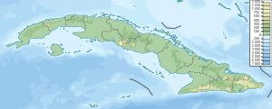
 Location of San Luis in Cuba | |
| Coordinates: 22°16′58″N 83°46′5″W / 22.28278°N 83.76806°WCoordinates: 22°16′58″N 83°46′5″W / 22.28278°N 83.76806°W | |
| Country |
|
| Province | Pinar del Río |
| Founded | 1827[1] |
| Established | 1879 |
| Area[2] | |
| • Total | 765 km2 (295 sq mi) |
| Elevation | 25 m (82 ft) |
| Population (2004)[3] | |
| • Total | 34,085 |
| • Density | 1,879/km2 (4,870/sq mi) |
| Time zone | UTC-5 (EST) |
| Area code(s) | +53-82 |
San Luis is a municipality and town in the Pinar del Río Province of Cuba. It is centered mainly on agriculture (tobacco, rice, fruit crops), stock raising.
History
It was founded in 1827,[1] and established as a municipality in 1879, when it split from San Juan y Martínez. Until 1977, its territory included the seaport village of La Coloma, currently part of Pinar del Río.[4]
Geography
The municipality is located west of Pinar del Río and includes the villages of Barbacoa, Barrigonas, Buenavista, El Corojo, El Retiro, Llanadas, Palizada, Santa María and Tirado.[1]
Demographics
In 2004, the municipality of San Luis had a population of 34,085.[3] With a total area of 765 km2 (295 sq mi),[2] it has a population density of 44.6/km2 (116/sq mi).
See also
References
- 1 2 3 Guije.com. "San Luis" (in Spanish). Retrieved 2007-10-07.
- 1 2 Statoids (July 2003). "Municipios of Cuba". Retrieved 2007-10-07.
- 1 2 Atenas.cu (2004). "2004 Population trends, by Province and Municipality". Archived from the original on September 27, 2007. Retrieved 2007-10-07. (in Spanish)
- ↑ (in Spanish) La Coloma on guije.com
External links

This article is issued from
Wikipedia.
The text is licensed under Creative Commons - Attribution - Sharealike.
Additional terms may apply for the media files.