San Joaquín Municipality, Carabobo
| San Joaquín Municipality Municipio San Joaquín | |||
|---|---|---|---|
| Municipality | |||
| |||
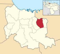 Location in Carabobo | |||
.svg.png) San Joaquín Municipality Location in Venezuela | |||
| Coordinates: 10°15′45″N 67°47′32″W / 10.2625°N 67.7922°WCoordinates: 10°15′45″N 67°47′32″W / 10.2625°N 67.7922°W | |||
| Country |
| ||
| State | Carabobo | ||
| Municipal seat | San Joaquín | ||
| Government | |||
| • Mayor | Luis Aguiar (PSUV) | ||
| Area | |||
| • Total | 127 km2 (49 sq mi) | ||
| Population (2011) | |||
| • Total | 64,124 | ||
| • Density | 500/km2 (1,300/sq mi) | ||
| Time zone | UTC−04:00 (VET) | ||
| Area code(s) | 0245 | ||

The San Joaquín Municipality is one of the 14 municipalities (municipios) that makes up the Venezuelan state of Carabobo and, according to the 2011 census by the National Institute of Statistics of Venezuela, the municipality has a population of 64,124. [1] The town of San Joaquín is the municipal seat of the San Joaquín Municipality.[2]
Location
It borders Aragua State to the north, the Lake Valencia to the south, the Diego Ibarra Municipality to the east, and the Guacara Municipality to the west.
Demographics
The San Joaquín Municipality, according to a 2007 population estimate by the National Institute of Statistics of Venezuela, has a population of 60,953 (up from 48,946 in 2000). This amounts to 2.7% of the state's population.[3] The municipality's population density is 479.94 inhabitants per square kilometre (1,243.0/sq mi).[4]
Government
The mayor of the San Joaquín Municipality is Luis Aguiar, elected on November 23, 2008 with 55% of the vote.[5] He replaced César Emilio Hernández Meza shortly after the elections. The municipality is divided into one parish (San Joaquín).[2]
See also
References
- ↑ http://www.geohive.com/cntry/venezuela_ext.aspx
- 1 2 http://www.ine.gob.ve/secciones/division/Carabobo.zip%5Bpermanent+dead+link%5D
- ↑ http://www.ine.gob.ve/sintesisestadistica/estados/carabobo/cuadros/Poblacion5.xls%5Bpermanent+dead+link%5D
- ↑ http://www.ine.gob.ve/sintesisestadistica/estados/carabobo/cuadros/Poblacion4.xls%5Bpermanent+dead+link%5D
- ↑ http://www.cne.gob.ve/divulgacion_regionales_2008/index.php?e=07&m=00&p=00&c=00&t=00&ca=00&v=02
External links
- sanjoaquin-carabobo.gov.ve (in Spanish)