San Antonio de Flores, El Paraíso
| San Antonio de Flores | |
|---|---|
| Municipality | |
 San Antonio de Flores Location in Honduras | |
| Coordinates: 13°43′N 86°53′W / 13.717°N 86.883°W | |
| Country | Honduras |
| Department | El Paraíso |
| Area | |
| • Total | 155 km2 (60 sq mi) |
| Population (2015) | |
| • Total | 5,674 |
| • Density | 37/km2 (95/sq mi) |
San Antonio de Flores is a municipality in the Honduran department of El Paraíso.
It's a municipality located between mountains and it is close to the border with Nicaragua.
Capital: Yuscarán | ||
| Municipalities | 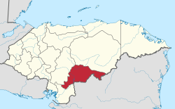 | |
Coordinates: 13°43′0″N 86°53′0″W / 13.71667°N 86.88333°W
This article is issued from
Wikipedia.
The text is licensed under Creative Commons - Attribution - Sharealike.
Additional terms may apply for the media files.