San Andrés, San Andrés y Providencia
| San Andrés | |
|---|---|
| City and municipality | |
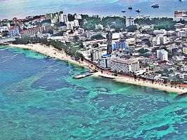    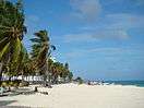  San Andrés Island. View of San Andrés Beach | |
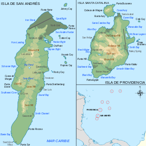 Maps of the islands of San Andrés and Providencia | |
 San Andrés Location of San Andrés in Colombia | |
| Coordinates: 12°35′5″N 81°42′2″W / 12.58472°N 81.70056°WCoordinates: 12°35′5″N 81°42′2″W / 12.58472°N 81.70056°W | |
| Country |
|
| Region | Insular |
| Department | San Andrés, Providencia y Santa Catalina |
| Area | |
| • Total | 26 km2 (10 sq mi) |
| Population (2005) | |
| • Total | 55,426[1] |
| • Languages spoken | Creole, English, Spanish |
| • Ethnic groups | 20% Raizals and 80% mainland Colombians |
| Time zone | UTC-05 (Eastern Time Zone) |
San Andrés (Spanish pronunciation: [ˌsan anˈdɾes]) is the capital city of the department of San Andrés, Providencia and Santa Catalina, in Colombia. As of 2005 its population was of 55,426.[1]
Overview
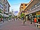
It is situated at the north end of San Andrés Island, on the Caribbean Sea. The population is considered to be about 20% Raizals and 80% mainland Colombians. The economy is mainly sustained by tourism and commercial fishing. Once a duty-free port, it still has a relatively vigorous shopping district selling various consumer goods at bargain prices, including Colombian gold and emerald jewellery, leather goods and other distinctively Colombian wares.
San Andres has become such a byword for bargain shopping in Colombia that many towns and cities have a bargain shopping area known as a San Andresito ("little San Andres").
Twin towns
References
- 1 2 (in Spanish) "Census 2005 - San Andrés" (PDF). (DANE)
External links
![]()