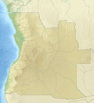
Sambizanga
 Angola | |
| Location |
Ponta das Lagostas Sambizanga Angola |
|---|---|
| Coordinates | 8°45′26″S 13°18′11″E / 8.757361°S 13.303°E |
| Year first constructed |
1880 (first) 1930 (second)[1] |
| Year first lit | n/a (current) |
| Deactivated | 1930 (first) |
| Foundation | concrete base |
| Construction |
fiber glass tower (current) masonry tower (first & second)[1] |
| Tower shape |
cylindrical tower with balcony and lantern (current) quadrangular tower atop a 2-storey keeper’s house quadrangular tower with balcony and lantern (second) [1] |
| Markings / pattern |
white and red horizontal band tower (current) white tower (first & second) [1] |
| Height |
15 metres (49 ft) (current) 14 metres (46 ft) (second)[1] |
| Focal height | 81 metres (266 ft)[2] |
| Light source | solar power |
| Range | 7 nautical miles (13 km; 8.1 mi)[2] |
| Characteristic | Oc (2) R 6s.[2] |
| Admiralty number | D5100[2] |
| NGA number | 25576[2] |
| ARLHS number | ANO-014[1] |
| Angola number | PT-5204[1] |
| Managing agent | Instituto Marítimo e Portuário de Angola |
Sambizanga is one of the six urban districts that make up the municipality of Luanda, in the province of Luanda.
Overview
Sambizanga has 14.5 km ² and about 244,000 inhabitants. Limited to the west by the Atlantic Ocean, on the north by the municipality of Cacuaco, in the East by the municipality of Cazenga and south by the municipalities of Ingombota and Rangel. It comprises the municipalities of Sambizanga, Bairro Operário and Ngola Kiluanje. Sambizanga is home to the Progresso Associação do Sambizanga football club of the Girabola.
Mercado Roque Santeiro, the largest open-air market in Africa, was located in the district.[3]
2007 Shooting
In December 2007, film director Radical Ribeiro began shooting a film in Sambizanga. On 18 December, police mistook actors in Ribeiro's film, who were carrying unloaded firearms, as actual criminals and opened fire on them, killing two. Interior Minister Roberto Leal Monteiro said "We won't rest until police at all levels realise they are public servants,"
See also
References
- 1 2 3 4 5 6 7 "Angola". The Lighthouse Directory. University of North Carolina at Chapel Hill. Retrieved 12 May 2017.
- 1 2 3 4 5 List of Lights, Pub. 113: The West Coasts of Europe and Africa, the Mediterranean Sea, Black Sea and Azovskoye More (Sea of Azov) (PDF). List of Lights. United States National Geospatial-Intelligence Agency. 2016.
- ↑ "BBC News - Angolan traders mourn loss of Roque Santeiro market". news.bbc.co.uk. Retrieved 2016-10-10.
External links
- Angolan actors 'killed by police' BBC News, 18 December 2007
- Outrage at Angola actor shooting BBC News, 19 December 2007
Coordinates: 6°05′S 15°06′E / 6.083°S 15.100°E