Sam Rayburn, Texas
| Sam Rayburn, Texas | |
|---|---|
| Census-designated place | |
 Sam Rayburn, Texas | |
| Coordinates: 31°03′51″N 94°02′09″W / 31.06417°N 94.03583°WCoordinates: 31°03′51″N 94°02′09″W / 31.06417°N 94.03583°W | |
| Country | United States |
| State | Texas |
| County | Jasper |
| Area[1] | |
| • Total | 9.931 sq mi (25.72 km2) |
| • Land | 8.469 sq mi (21.93 km2) |
| • Water | 1.462 sq mi (3.79 km2) |
| Elevation | 200 ft (60 m) |
| Population (2010)[2] | |
| • Total | 1,181 |
| • Density | 120/sq mi (46/km2) |
| Time zone | UTC-6 (Central (CST)) |
| • Summer (DST) | UTC-5 (CDT) |
| Area code(s) | 409 |
| GNIS feature ID | 2035025[3] |
Sam Rayburn is a census-designated place and unincorporated community in Jasper County, Texas, United States. Its population was 1,181 as of the 2010 census.[2] The community, which is also known as Rayburn Country, is located on the south shore of the Sam Rayburn Reservoir at the junction of Texas Recreational Road 255 and Farm to Market Road 1007.[4] Sam Rayburn was founded in the 1970s after the formation of the reservoir; its main attraction is its country club, Rayburn Country.[5]
References
- ↑ "US Gazetteer files: 2010, 2000, and 1990". United States Census Bureau. 2011-02-12. Retrieved 2011-04-23.
- 1 2 "American FactFinder". United States Census Bureau. Retrieved 2011-05-14.
- ↑ "Sam Rayburn". Geographic Names Information System. United States Geological Survey.
- ↑ County Grid Map Page 609 (PDF) (Map). Texas Department of Transportation. 2010. Retrieved July 21, 2012.
- ↑ Jasinski, Laurie E. "Sam Rayburn, TX". Handbook of Texas. Texas State Historical Association. Retrieved July 21, 2012.
Municipalities and communities of Jasper County, Texas, United States | ||
|---|---|---|
| Cities | 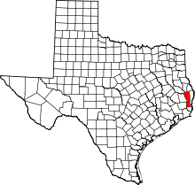 | |
| CDPs | ||
| Unincorporated communities | ||
| Ghost towns | ||
| Footnotes | ‡This populated place also has portions in an adjacent county or counties | |
This article is issued from
Wikipedia.
The text is licensed under Creative Commons - Attribution - Sharealike.
Additional terms may apply for the media files.