Salt Creek (Platte River)
| Salt Creek | |
| Creek | |
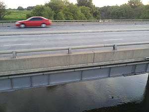 Salt Creek and the Superior St overpass, as seen from the Superior Street Trail, around 38th & Superior in Lincoln, NE. | |
| Country | United States |
|---|---|
| State | Nebraska |
| Region | Great Plains |
| Part of | Platte River basin |
| City | Lincoln |
| Mouth | Platte River |
| - location | Mahoney State Park, Ashland, Saunders County, Nebraska, United States |
| - elevation | 1,040 ft (317 m) [1] |
| - coordinates | 41°02′08″N 96°18′42″W / 41.03556°N 96.31167°WCoordinates: 41°02′08″N 96°18′42″W / 41.03556°N 96.31167°W [1] |
Salt Creek is a tributary of the Platte River, located in Saunders, Cass, and Lancaster counties in southeast Nebraska. It is approximately 44.38 miles (71.42 km) in length.[1] It connects to the Platte River at Mahoney State Park in Ashland.
Among species found along Salt Creek are the critically endangered Salt Creek tiger beetle, of which fewer than 200 individuals existed in 2009.[2]
Tributaries of Salt Creek
Salt Creek has fifteen tributaries of its own: Oak Creek, Stevens Creek, Middle Creek, Antelope Creek, Elk Creek, Beal Slough, Haines Branch, Cardwell Branch, Lynn Creek, Deadman's Run, Little Salt Creek, Rock Creek, Camp Creek, Wahoo Creek, Dee Creek,.[3]
See also
References
- 1 2 3 "Salt Creek". Geographic Names Information System. United States Geological Survey. Retrieved 8 May 2013.
- ↑ Algis J. Laukaitis (5 Oct 2009). "Salt Creek tiger beetle featured in Goodall's book on at-risk species". Lincoln Journal-Star. Retrieved 8 May 2013.
- ↑ "Archived copy". Archived from the original on 2012-06-25. Retrieved 2016-02-15.
This article is issued from
Wikipedia.
The text is licensed under Creative Commons - Attribution - Sharealike.
Additional terms may apply for the media files.