Saint-Sulpice-de-Mareuil
| Saint-Sulpice-de-Mareuil | |
|---|---|
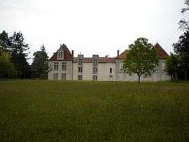 Chateau of La Faye | |
 Saint-Sulpice-de-Mareuil Location within Nouvelle-Aquitaine region  Saint-Sulpice-de-Mareuil | |
| Coordinates: 45°28′06″N 0°30′27″E / 45.4683°N 0.5075°ECoordinates: 45°28′06″N 0°30′27″E / 45.4683°N 0.5075°E | |
| Country | France |
| Region | Nouvelle-Aquitaine |
| Department | Dordogne |
| Arrondissement | Nontron |
| Canton | Brantôme |
| Area1 | 11.35 km2 (4.38 sq mi) |
| Population (2008)2 | 121 |
| • Density | 11/km2 (28/sq mi) |
| Time zone | UTC+1 (CET) |
| • Summer (DST) | UTC+2 (CEST) |
| INSEE/Postal code | 24503 /24340 |
| Elevation |
115–225 m (377–738 ft) (avg. 150 m or 490 ft) |
|
1 French Land Register data, which excludes lakes, ponds, glaciers > 1 km2 (0.386 sq mi or 247 acres) and river estuaries. 2 Population without double counting: residents of multiple communes (e.g., students and military personnel) only counted once. | |
Saint-Sulpice-de-Mareuil is a former commune in the Dordogne department in Nouvelle-Aquitaine in southwestern France. On 1 January 2017, it was merged into the new commune Mareuil en Périgord.[1]
Geography
The Lizonne forms the commune's northern border.
Population
| Historical population | ||
|---|---|---|
| Year | Pop. | ±% |
| 1962 | 205 | — |
| 1968 | 170 | −17.1% |
| 1975 | 137 | −19.4% |
| 1982 | 128 | −6.6% |
| 1990 | 131 | +2.3% |
| 1999 | 114 | −13.0% |
| 2008 | 121 | +6.1% |
See also
References
- ↑ Arrêté préfectoral 26 September 2016 (in French)
| Wikimedia Commons has media related to Saint-Sulpice-de-Mareuil. |
| Authority control |
|---|
This article is issued from
Wikipedia.
The text is licensed under Creative Commons - Attribution - Sharealike.
Additional terms may apply for the media files.