Saint-Michel-des-Andaines
| Saint-Michel-des-Andaines | |
|---|---|
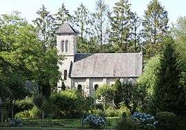 Saint Ortaire priory | |
 Saint-Michel-des-Andaines Location within Normandy region  Saint-Michel-des-Andaines | |
| Coordinates: 48°34′51″N 0°24′52″W / 48.5808°N 0.4144°WCoordinates: 48°34′51″N 0°24′52″W / 48.5808°N 0.4144°W | |
| Country | France |
| Region | Normandy |
| Department | Orne |
| Arrondissement | Alençon |
| Canton | La Ferté-Macé |
| Government | |
| • Mayor (2008–2014) | Sylvain Jarry |
| Area1 | 6.44 km2 (2.49 sq mi) |
| Population (2006)2 | 306 |
| • Density | 48/km2 (120/sq mi) |
| Time zone | UTC+1 (CET) |
| • Summer (DST) | UTC+2 (CEST) |
| INSEE/Postal code | 61431 /61600 |
| Elevation |
185–253 m (607–830 ft) (avg. 194 m or 636 ft) |
|
1 French Land Register data, which excludes lakes, ponds, glaciers > 1 km2 (0.386 sq mi or 247 acres) and river estuaries. 2 Population without double counting: residents of multiple communes (e.g., students and military personnel) only counted once. | |
Saint-Michel-des-Andaines is a former commune in the Orne department in north-western France. On 1 January 2016, it was merged into the new commune of Bagnoles-de-l'Orne-Normandie.[1]
See also
References
- ↑ Arrêté préfectoral 18 November 2015 (in French)
| Wikimedia Commons has media related to Saint-Michel-des-Andaines. |
This article is issued from
Wikipedia.
The text is licensed under Creative Commons - Attribution - Sharealike.
Additional terms may apply for the media files.