Saint-Michel-Mont-Mercure
| Saint-Michel-Mont-Mercure | |
|---|---|
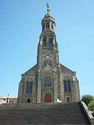 The church in Saint-Michel-Mont-Mercure | |
 Saint-Michel-Mont-Mercure Location within Pays de la Loire region  Saint-Michel-Mont-Mercure | |
| Coordinates: 46°49′51″N 0°52′54″W / 46.8308°N 0.8817°WCoordinates: 46°49′51″N 0°52′54″W / 46.8308°N 0.8817°W | |
| Country | France |
| Region | Pays de la Loire |
| Department | Vendée |
| Arrondissement | Fontenay-le-Comte |
| Canton | Les Herbiers |
| Intercommunality | Pays de Pouzauges |
| Government | |
| • Mayor (2008–2014) | Bernard Martineau |
| Area1 | 25.76 km2 (9.95 sq mi) |
| Population (2006)2 | 2,071 |
| • Density | 80/km2 (210/sq mi) |
| Time zone | UTC+1 (CET) |
| • Summer (DST) | UTC+2 (CEST) |
| INSEE/Postal code | 85257 /85700 |
| Elevation | 119–290 m (390–951 ft) |
|
1 French Land Register data, which excludes lakes, ponds, glaciers > 1 km2 (0.386 sq mi or 247 acres) and river estuaries. 2 Population without double counting: residents of multiple communes (e.g., students and military personnel) only counted once. | |
Saint-Michel-Mont-Mercure is a former commune in the Vendée department in the Pays de la Loire region in western France. On 1 January 2016, it was merged into the new commune of Sèvremont.[1]
See also
References
- ↑ Arrêté préfectoral 18 December 2015
| Wikimedia Commons has media related to Saint-Michel-Mont-Mercure. |
This article is issued from
Wikipedia.
The text is licensed under Creative Commons - Attribution - Sharealike.
Additional terms may apply for the media files.