Saint-Just, Eure
| Saint-Just | |
|---|---|
 | |
 Saint-Just Location within Normandy region  Saint-Just | |
| Coordinates: 49°06′34″N 1°26′31″E / 49.1094°N 1.4419°ECoordinates: 49°06′34″N 1°26′31″E / 49.1094°N 1.4419°E | |
| Country | France |
| Region | Normandy |
| Department | Eure |
| Arrondissement | Évreux |
| Canton | Pacy-sur-Eure |
| Area1 | 4.44 km2 (1.71 sq mi) |
| Population (2008)2 | 1,333 |
| • Density | 300/km2 (780/sq mi) |
| Time zone | UTC+1 (CET) |
| • Summer (DST) | UTC+2 (CEST) |
| INSEE/Postal code | 27554 /27950 |
| Elevation |
13–139 m (43–456 ft) (avg. 32 m or 105 ft) |
|
1 French Land Register data, which excludes lakes, ponds, glaciers > 1 km2 (0.386 sq mi or 247 acres) and river estuaries. 2 Population without double counting: residents of multiple communes (e.g., students and military personnel) only counted once. | |
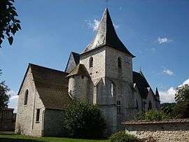
Saint-Just is a former commune in the Eure department in Normandy in northern France. On 1 January 2017, it was merged into the new commune La Chapelle-Longueville.[1]
Population
| Historical population | ||
|---|---|---|
| Year | Pop. | ±% |
| 1962 | 444 | — |
| 1968 | 506 | +14.0% |
| 1975 | 756 | +49.4% |
| 1982 | 840 | +11.1% |
| 1990 | 855 | +1.8% |
| 1999 | 1,292 | +51.1% |
| 2008 | 1,333 | +3.2% |
See also
References
- ↑ Arrêté préfectoral 3 August 2016 (in French)
| Wikimedia Commons has media related to Saint-Just (Eure). |
This article is issued from
Wikipedia.
The text is licensed under Creative Commons - Attribution - Sharealike.
Additional terms may apply for the media files.