Saint-François River
| Saint-François River (Rivière Saint-François) | |
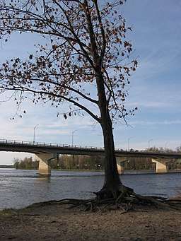 A tree on the banks of the Saint-François River in Drummondville | |
| Country | Canada |
|---|---|
| Province | Quebec |
| Regions | Estrie, Chaudière-Appalaches, Centre-du-Québec |
| Tributaries | |
| - left | Magog River |
| Cities | Sherbrooke, Drummondville |
| Source | Lac Saint-François |
| - location | Lambton, Estrie, Quebec, Canada |
| - elevation | 289 m (948 ft) |
| - coordinates | 45°53′55″N 71°09′28″W / 45.89861°N 71.15778°W |
| Mouth | |
| - location | Pierreville, Centre-du-Québec, Quebec, Canada |
| - coordinates | 46°07′09″N 72°55′28″W / 46.11917°N 72.92444°WCoordinates: 46°07′09″N 72°55′28″W / 46.11917°N 72.92444°W |
| Length | 218 km (135 mi) |
| Basin | 10,230 km2 (3,950 sq mi) |
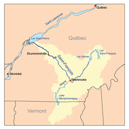 Map of the Saint-François River watershed | |
The Saint-François River is a river in the Canadian province of Quebec.
The Saint-François takes its source from Lake Saint-François in Chaudière-Appalaches, southeast of Thetford Mines. It flows southwest towards Sherbrooke, where it changes it course northwest towards Drummondville, and finally empties into the Saint Lawrence River near Pierreville.
About 15 kilometres (9 mi) upstream of the centre of Drummondville, a meander in the river forms a shape strongly resembling a profile drawing of a duck's head and neck, with an island marking the eye. The peninsula forming the "beak of the duck" is named accordingly, le Bec du Canard, and the road running along it is Rue du Bec-du-Canard.[1][2][3]
References
- ↑ Satellite view on classic Google Maps
- ↑ Page with oblique aerial photo
- ↑ Saint-Nicéphore in the French Wikipedia
This article is issued from
Wikipedia.
The text is licensed under Creative Commons - Attribution - Sharealike.
Additional terms may apply for the media files.